 Write to the booksellers
-
Type
Artists book (1)
Book (8423)
Engraving (3)
Magazine (10)
Maps (356)
-
Latest
Last 3 days (4)
Last month (117)
Last week (14)
-
Language
Bulgarian (1)
English (1)
French (8773)
German (10)
Italian (1)
Polish (1)
Portuguese (1)
Russian (1)
Spanish (4)
-
Century
16th (8)
17th (21)
18th (195)
19th (1471)
20th (2890)
21st (434)
-
Countries
Belgium (136)
Brazil (1)
Canada (3)
China (26)
Côte d'Ivoire (1)
Denmark (39)
France (8363)
Greece (1)
Netherlands (2)
Switzerland (220)
United States of America (1)
-
Syndicate
ALAC (3)
CLAQ (2)
CNE (1)
ILAB (6986)
NVVA (127)
SLACES (127)
SLAM (6802)
SNCAO (2)
ATLAS DE L'EUROPE DE L'OUEST
S.E.D.E.I.. 1961. In-Folio. Relié. Bon état, Coins frottés, Coiffe en tête abîmée, Intérieur frais. 46 pages - nombreuses photos et cartes couleur et noir et blanc dans et hors texte. . . . Classification Dewey : 912-Atlas, cartes et plans
Préface de Paul-Henri Spaak Classification Dewey : 912-Atlas, cartes et plans
Atlas mondial
Girard, Barrière et Thomas. 1951. In-4. Cartonné. Bon état, Couv. convenable, Dos satisfaisant, Intérieur frais. 126+91 pages augmentées de nombreuses cartes en couleurs, hors texte. Texte sur deux colonnes. Coins un peu frottés.. . . . Classification Dewey : 912-Atlas, cartes et plans

Classification Dewey : 912-Atlas, cartes et plans
[DOMANGE ROUSSELOT ] - Domange, Jacques [Jacques Vaissier, 1923 - 2000], Illustrateur. [Dessins, notes et croquis conservés par ] M. Wagner Edmund [Mis en textes par] M. Umhey Alfred Préface de Blondieau Christian ; Biographie par Natalia Griffon de Pleineville.
Reference : SHL-38
(2006)
L'armée de Napoléon. Uniformes du Ier Empire, 1792-1815.
Paris, Le Livre Chez Vous, 2006, un fort vol. in-4 oblong (25x31) pleine percaline verte d'éditeur, titre doré au dos et sur le premier plat, jaquette et étui illustrés, 519 pp. Croquis in-texte et 231 planches en couleurs avec explications en regard. Inédite et unique édition des recherches uniformologiques, notes, croquis et dessins aquarellés de Jacques Domange, collaborateur et successeur de Lucien Rousselot, comprenant entre autres des planches rares sur les troupes étrangères auxiliaires, les corps de volontaires ou les corps francs de la République. Très bon état général, infimes traces en tête de la jaquette, toutes petites salissures en tête de l’étui.
![L'armée de Napoléon. Uniformes du Ier Empire, 1792-1815. . Domange, Jacques [Jacques Vaissier, 1923 - 2000], Illustrateur.
[Dessins, notes et croquis ...](https://static.livre-rare-book.com/pictures/SHL/shl-38_1_thumb.jpg)
![L'armée de Napoléon. Uniformes du Ier Empire, 1792-1815. . Domange, Jacques [Jacques Vaissier, 1923 - 2000], Illustrateur.
[Dessins, notes et croquis ...](https://static.livre-rare-book.com/pictures/SHL/shl-38_2_thumb.jpg)
![L'armée de Napoléon. Uniformes du Ier Empire, 1792-1815. . Domange, Jacques [Jacques Vaissier, 1923 - 2000], Illustrateur.
[Dessins, notes et croquis ...](https://static.livre-rare-book.com/pictures/SHL/shl-38_3_thumb.jpg)
Frais de port en sus, établis au plus juste selon la destination et le mode d'expédition : La Poste, Mondial Relay, etc...
Phone number : 06 62 70 79 32
ATLAS DU MONDE
COMPAGNIE FRANCAISE. NON DATE. In-8. Cartonné. Etat d'usage, Coins frottés, Dos satisfaisant, Intérieur frais. IV + 28 pages + VIII - nombreuses cartes et photos en noir et blanc et en couleurs dans et hors texte - 1er plat illustré - 1 annotation sur le 1er contre-plat.. . . . Classification Dewey : 912-Atlas, cartes et plans
28 CARTES EN COULEURS - 48 PHOTOGRAPHIES. Classification Dewey : 912-Atlas, cartes et plans
Atlas de poche des insectes de France utiles ou nuisibles.
In 12 pleine toile d'éditeur,titre au dos et sur le premier plat,insecte reproduit sur le deuxième plat.150pages,16 pages de catalogue,tranches rouges,72 planches coloriées représentant 322 insectes avec un texte de louis Planet. Paul Klincksieck 1896.bibliothèque de poche du naturaliste IV.
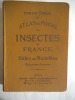
ATLAS DE POCHE DES INSECTES DE FRANCE
Klincksieck.1903.In-12,cartonnage éditeur.Planches en couleurs.BE.
Atlas géographique et statistique des départements de la France, de l'Algérie et des Colonies Françaises
1841 B.Dusillion, Paris, 1841- Un volume grand in Folio (597x438 mm), Titre gravé et 89 cartes doubles montées sur onglet, de dimension 597x850 mm.Interieur bon,dos manquant
Superbe atlas, que l'on trouve rarement complet, les cartes de grandes dimensions étant généralement vendues à l'unité. Remise de 20% pour toutes commandes supérieures à 200 €
Phone number : 33 04 94 63 34 56
Atlas de l'empire américain - Etats-Unis : géostratégie de l'hyperpuissance - Collection Atlas/Monde.
Autrement. 2006. In-8. Broché. Bon état, Couv. convenable, Dos satisfaisant, Intérieur frais. 79 pages - couverture contrepliée - nombreuses cartes en couleurs dans le texte - gommette collée sur le 2ème plat.. . . . Classification Dewey : 912-Atlas, cartes et plans
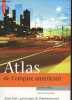
Préface de Patrice de Beer - Collection Atlas/Monde - Cartographie de Madeleine Benoît-Guyod. Classification Dewey : 912-Atlas, cartes et plans
Atlas de l'empire américain. Etats-Unis : géostratégie de l'hyperpuissance
Editions Autrement Atlas/Monde Dos carré collé 2006 In-8 (17 x 24,5 cm), dos carré collé, 79 pages ; galerie de vers dans le quatrième plat et les deux derniers feuillets, par ailleurs assez bon état général. Livraison a domicile (La Poste) ou en Mondial Relay sur simple demande.

Atlas de l'empire américain.
AUTREMENT / COURRIER INTERNATIONAL. Non daté. In-8. Broché. Très bon état, Couv. fraîche, Dos satisfaisant, Intérieur frais. 64 pages de cartes et graphiques en couleurs, dans le texte.. . . . Classification Dewey : 912-Atlas, cartes et plans
"""Tout un Monde en cartes."" Classification Dewey : 912-Atlas, cartes et plans"
Chez les Beautés aux dents limées
Paris, Edité par les Laboratoires Martinet, 1930. 1 volume in-12 carré, broché, couverture souple, 110 pp., bon état général.
Séjour chez les Moïs d'Indochine et réflexions sur leurs moeurs et coutumes. Roland Dorgelès était Membre de l'Académie Goncourt et auteur de la célèbre Route Mandarine.
Atlas van Nederlandsch Oost-en West-Indië. 3e Druk.-
Amsterdam. Seyffardt's Boekhandel. 1884. In-folio (ca 260 x 396 mm) reliure très abîmée, vendu uniquement pour les 25 cartes en couleurs, sur les 26 annoncées, en doubles pages montées sur onglets, en excellent état sauf la planche 1, très lgt abîmée. La planche 14 est chiffrée 19 et il manque la planche 20 des Célèbes
Voyage au Congo et dans l'intérieur de l'Afrique Equinoxiale, fait pendant les années 1828, 1829 et 1830.
Paris, Jules Renouard, 1832. 3 vol. in-8° (21,5x14cm) de xxxj, 1 bl., 328 pp. ; 380 pp. ; 272 pp. et son Atlas in-folio (37x29cm) de titre, [1] p., 1 grande carte dépliante et 21 planches lithographiées (la n° 6 en double). Demi-chagrin miel à coins, dos à 5 faux-nerfs orné, p. de t. en maroquin fauve, tomaison dorée en pied, tête dorée, couverture et dos conservé (Reliure moderne). Des rousseurs, quelques pl. de l'Atlas légèrement brunies, coiffe sup. de l’atlas légèrement frottée. Étiquette de librairie, le frontispice figurant la médaille reçue par l’auteur est en déficit. Bel ensemble.
Explorateur et aventurier français, Douville fut le premier à pénétrer dans des régions totalement inconnues au cœur de l'Afrique. Depuis la province portugaise d'Angola, où il entreprit un premier voyage de onze mois à travers les possessions portugaises et les territoires avoisinants, il s'aventura lors d'un second périple jusqu'aux contrées lointaines du Lunda et de régions situées bien plus au nord, rapportant des informations alors entièrement inédites. Ses observations ethnographiques sont remarquables, notamment en ce qui concerne la description politique des royaumes et des tribus africaines. L'une des pages les plus saisissantes est celle que Douville consacre à l'histoire de la formation du royaume de Bihé, émancipation politique qui se serait produite au moment de la conquête portugaise. L'ouvrage contient également de nombreuses observations géologiques, en particulier sur l'existence d'une mine d'or, des faits aujourd'hui avérés. Douville était animé, au cours de son voyage, d'un but commercial : acheter des esclaves à bas prix. La traite des esclaves, leurs prix et leur acheminement y sont donc largement évoqués. Si ce voyage lui valut une gloire immédiate, il fut rapidement accusé d'affabulation par une revue anglaise. Certes, les zones d'ombre entourant la biographie de Douville sont troublantes et son récit comporte quelques inexactitudes, mais ses observations furent confirmées bien plus tard, et l'ensemble de son itinéraire a été validé par Anne Stamm dans les Cahiers d'études africaines, qui a étudié le récit avec une grande rigueur. Le tome 3 se clôt sur des statistiques des villes, bourgs et villages, ainsi qu'un vocabulaire de la langue Mogialoua et de ses deux principaux dialectes, l'Abunda et le Congo. Ch-2A & 1C
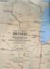
Carte : Close-Up, Canada : Ontario
National Geographic Society. 1978. In-Plano. En feuillets. Bon état, Livré sans Couverture, Dos satisfaisant, Intérieur frais. Une carte dépliante en couleurs recto-verso. Quelques illustrations en couleurs au verso. Texte en anglais. Echelle : 1/3000000. 80 x 56 cm environ.. . . . Classification Dewey : 912-Atlas, cartes et plans
Classification Dewey : 912-Atlas, cartes et plans
Carte : Close-Up, U.S.A. - The Northeast
National Geographic Society. 1978. In-Plano. En feuillets. Bon état, Livré sans Couverture, Dos satisfaisant, Intérieur frais. Une carte dépliante en couleurs recto-verso. Nombreuses illustrations en couleurs au verso. Texte en anglais. Echelle : 1/1215000. 56 x 88 cm environ.. . . . Classification Dewey : 912-Atlas, cartes et plans

Classification Dewey : 912-Atlas, cartes et plans
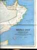
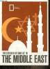
Carte : Middle East / Early Civilizations in the Middle East
National Geographic Society. 1978. In-Plano. En feuillets. Bon état, Couv. convenable, Dos satisfaisant, Intérieur frais. Une carte dépliante en couleurs recto-verso. Texte en anglais. Echelles : 1/6700000 et 1/1775000. 56 x 92 cm environ.. . . . Classification Dewey : 912-Atlas, cartes et plans
Classification Dewey : 912-Atlas, cartes et plans
Carte : Two centuries of conflict in the Middle East / Mideast in Turmoil
National Geographic Magazine. 1980. In-Plano. En feuillets. Bon état, Couv. convenable, Dos satisfaisant, Intérieur frais. Une carte dépliante en couleurs recto-verso. Texte en anglais. Echelle 1/50.000.000. 34 x 52 cm environ.. . . . Classification Dewey : 912-Atlas, cartes et plans
Classification Dewey : 912-Atlas, cartes et plans
Plan de Sévastopol
GARNIER FRERES. 1855. In-Plano. En feuillets. Bon état, Couv. convenable, Dos satisfaisant, Intérieur frais. Plan dépliant en couleur avec une gravure de la rue de Sévastopol 60 x 45 cm.. . . . Classification Dewey : 912-Atlas, cartes et plans
plan de Sévastopol avec ses fortifications, ses batteries, la portée de ses canons et la position des armées. De la carte de la Crimée et du plan de Kroustadt. Classification Dewey : 912-Atlas, cartes et plans
Grand Atlas du monde
NGV. Non daté. In-Folio. Relié. Bon état, Coins frottés, Dos satisfaisant, Intérieur frais. 320 pages. Nombreuses cartes et photos en couleurs, in et hors texte. Frontispice illustré en couleurs. Rares rousseurs en tranches.. . . . Classification Dewey : 912-Atlas, cartes et plans
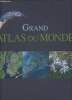
Classification Dewey : 912-Atlas, cartes et plans
STRASSENKATRTE Nr. 141. SÜDDEUTSCHLAND 1:500 000.
JRO-VERLAG, MÜNCHEN. NON DATE. In-8. Broché. Etat d'usage, Couv. légèrement passée, Dos satisfaisant, Intérieur frais. Carte illustrée en couleurs de 125 x 45 cm. Echelle au 1:500 000e.. . . . Classification Dewey : 912-Atlas, cartes et plans
Classification Dewey : 912-Atlas, cartes et plans
RECHERCHES SUR L'EVOLUTION DU RELIEF DANS LE MASSIF CENTRAL DU GRAND ATLAS LE HAOUZ ET LE SOUS
Tours, Arrault, 1941, 1941. in 4°, XIX-708 pp., 40 planches photographiques h.t., 206 figures in-t., biblio., index. Broché, très bon exemplaire. Très importante thèse de géographie,
Ray AA9*
NOUVEL ATLAS MONDIAL / 3E EDITION.
STAUFFACHER S.A. 1962. In-4. Relié. Etat d'usage, Couv. convenable, Dos satisfaisant, Intérieur frais. 500 cartes en couleurs géographie économie division politique climat géologie religions plans de villes de tous les pays - 500 illustrations en monochrome paysages peuples vie économique monuments du monde entier - jaquette en état d'usage - sous emboitage cartoné rigide marron en état d'usage - 3 photos disponibles.. Avec Jaquette. Sous Emboitage. . Classification Dewey : 912-Atlas, cartes et plans
Classification Dewey : 912-Atlas, cartes et plans
ATLAS MONDIALE
EDITIONS STAUFFACHER VERLAG. 1965. In-4. En feuillets. Bon état, Couv. convenable, Dos satisfaisant, Intérieur frais. 198 pages. Nombreuses illustrations en couleur et en noir et blanc, hors texte, rangée dans un classeur rouge.. . . . Classification Dewey : 912-Atlas, cartes et plans
Classification Dewey : 912-Atlas, cartes et plans
Carte d'Annapurna & Dhaulagari, Himal
INTERNATIONAL GRAPHIC ART. 1970. In-8. En feuillets. Bon état, Livré sans Couverture, Dos satisfaisant, Pliures. Carte dépliante de 50 / 60 cm, illustrée en couleurs. Echelle : 1 / 250000. Légendes en anglais.. . . A l'italienne. Classification Dewey : 912-Atlas, cartes et plans
Classification Dewey : 912-Atlas, cartes et plans