-
Type
Autograph (3)
Book (23845)
Drawings (9)
Engraving (16)
Magazine (132)
Manuscript (5)
Maps (20)
Music sheets (41)
Old papers (3)
Photographs (8)
Postcards (3)
Posters (1)
Public sale (1)
-
Latest
Last 24h (10)
Last 3 days (22)
Last month (162)
Last week (15)
-
Language
Czech (1)
Dutch (1)
English (24)
French (24053)
German (3)
Italian (1)
Latin (1)
Spanish (3)
-
Century
15th (1)
16th (9)
17th (82)
18th (544)
19th (4382)
20th (9903)
21st (1182)
-
Countries
Belgium (378)
Canada (44)
Côte d'Ivoire (15)
Denmark (760)
France (21367)
Germany (206)
Greece (4)
Italy (1)
Netherlands (4)
Switzerland (1308)
-
Syndicate
ALAC (44)
CLAM (8)
CLAQ (39)
CNE (13)
ILAB (14390)
NVVA (315)
SLACES (311)
SLAM (13147)
SNCAO (9)
Une adolescence
Robert Laffont | Paris 2015 | 13.50 x 21.50 cm | broché
Edition originale pour laquelle il n'a pas été tiré de grands papiers. Bel exemplaire complet de sa jaquette illustrée d'un dessin de Pierre Le Tan. Envoi autographe signé de Frédéric Mitterrand à Bernard Kouchner et Christine Okrent : "Pour Christine et Bernard avec toute ma profonde tendresse..." - Photographies et détails sur www.Edition-Originale.com -


Phone number : 01 56 08 08 85
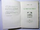
LA MORT DE PHILAE
Exemplaire sur vergé d'Arches n° 894 vol. broché,180x130, 243pp non coupées ,couvertures rempliées, non rognées, très bel exemplaire L'édition originale de ce livre parut en 1909. La mort de Philae est un livre, compte rendu d'impressions et d'observations de voyages. Le marin-académicien français y observe le basculement de l'Egypte dans le tourisme et son entrée dans la 'modernisation'. L'auteur est un écrivain français qui a mené en parallèle une carrière d'officier de marine. Une grande partie de son oeuvre est autobiographique. Loti est le pseudonyme qu'il choisit après son premier voyage à Tahiti, c'est une princesse tahitienne qui lui donna ce nom de fleur tropicale. Paris La Connaissance 1920 ref/92
[Raymond Woog, A. Devambez, René Lelong, Lobel-Riche, Manuel Orazi, Gaumet] - Pierre Loti
Reference : 22591
(1923)
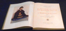
La Troisième Jeunesse de Madame Prune – Le Mariage de Loti
Paris, Éditions Pierre Lafitte , 1923 - Relié, demi-chagrin, percaline verte, pièces de titre et médaillon dorés, 22,5 cm x 30,5 cm, 239 pages, illustrations noir & blanc et couleur in et hors-texte. Textes de Pierre Loti, illustrations de Raymond Woog, A. Devambez, René Lelong, Lobel-Riche, Manuel Orazi, Gaumet. Très bon état
Le roman d'un spahi
En 1881, Loti a trente et un ans, et signe pour la première fois de son pseudonyme ce qui est son premier roman véritable. L'intrigue rendra l'auteur célèbre : un Français, transplanté dans une contrée lointaine, ici le Sénégal y connaît un grand amour. Il meurt ; sa maîtresse se tue, après avoir tué son enfant. On trouve dans ce récit l'Afrique, ses plaines, ses forêts, à l'époque peu connues, et décrites par la sensibilité d'un poète. On trouve la double aventure de l'amour et de la guerre. On trouve la grande lamentation de l'amour et de l'exil que reconnaissent à la première phrase, à la première mesure, tous les amoureux de Loti - qui connaît une nouvelle jeunesse, une renaissance dans le public. vol relié, in8, 180x120, demi toile, bel état intérieur, rousseurs, 380pp. Couvertures d'origines conservées. Paris, Calmann Lévy 1887 ref/105
[Georges Rochegrosse, Adler, R. X. Prinet, F. Gumery, Naurac, G. Pastré] - Pierre Loti
Reference : 22592
(1923)
Le Roman d’un Spahi – Mon Frère Yves
Paris, Éditions Pierre Lafitte , 1923. Relié, demi-chagrin, percaline verte, pièces de titre et médaillon dorés, 22,5 cm x 30,5 cm, 286 pages, illustrations noir & blanc et couleur in et hors-texte. Textes de Pierre Loti, illustrations de Georges Rochegrosse, Adler, R. X. Prinet, F. Gumery, Naurac, G. Pastré. Très bon état
[Muenier, Orazi, Lorenzi, Auburtin, Fouqueray et Lalau] - Pierre Loti
Reference : 22595
(1923)
Les Désenchantées - Matelot
Paris, Éditions Pierre Lafitte, 1923. Relié, demi-chagrin, percaline verte, pièces de titre et médaillon dorés, 22,5 cm x 30,5 cm, 275 pages, illustrations noir & blanc et couleur in et hors-texte. Textes de Pierre Loti, illustrations de Muenier, Orazi, Lorenzi, Auburtin, Fouqueray et Lalau. Très bon état
Mon frère Yves
Mon frère Yves est un roman semi-autobiographique de l'auteur français Pierre Loti. Il décrit l'amitié entre l'officier de marine français Pierre Loti et un marin breton alcoolique, Yves Kermadec, dans les années 1870 et 1880 vol relié, in8, 180x120, demi toile, bel état intérieur, rousseurs, 424pp. Couvertures d'origines conservées. Paris, Calmann Lévy 1887 ref/105
Prime jeunesse, suivi de Un jeune officier pauvre
Paris Clmann-Lévy 1937 19 x 23 cm reliure mosaïquée plein cuir richement décorée 309 pp Très nombreuses illustrations de A. E. Marty, pleine page et têtes de chapitres. Couverture conservée. Gardes papier chiffon (tendance à se froisser), renforcées de Canson fort. un ex. non numéroté sur Vélin à la forme.
Très bel état Photos de tous nos ouvrages sur demande
Pêcheur d'Islande.
Pêcheur d'Islande a sans doute souffert de son succès, considérable, et l'on ne relit plus beaucoup cette histoire d'amour qui fit tant pleurer nos grands-mères. Le chef-d'oeuvre de Loti n'en recèle pas moins de nombreuses qualités. Avec une construction savante, soigneusement équilibrée, un style sobre, à la limite de l'épure ("La mer, la mer grise"), des phrases ciselées, polies comme des galets, Loti accomplit un véritable travail d'artiste et de peintre pour évoquer ces horizons blancs, immensément vides, qui déchirent le ciel d'Islande. Lumières polaires irisées, brumes blafardes, soleils sans chaleur, impassibles et cruels, répondent aux tourments des coeurs, annoncent les amours brisées par la mort, les noces du marin et de la mer. Artisan scrupuleux, Loti trouve ici le chemin d'une poésie à la fois simple et profonde, où son chant s'épanouit en toute plénitude. --Scarbo La Marie, navigue vers l'Islande emmenant à son bord les pêcheurs bretons qu'on appelle les "Islandais". Pourtant, la mer du Nord est dangereuse, et chaque année, certains équipiers ne reviennent pas. Après avoir vécu à Paris, Gaud, une belle et douce jeune femme, revient vivre en Bretagne. Elle tombe alors éperdument amoureuse de Yann, marin sur La Marie. Mais, lui, n'aime que la mer... vol relié, in8, 180x120, demi toile, bel état intérieur, rousseurs, 320pp. Couvertures d'origines conservées. Paris, Calmann Lévy 1887 ref/105
[Henri Zo, Styka, Manuel Orazi, A. F. Gorguet, Zyg Brunner, Brunelleschi] - Pierre Loti
Reference : 22593
(1923)
Ramuntcho - Aziyadé
Paris, Éditions Pierre Lafitte , 1923. Relié, demi-chagrin, percaline verte, pièces de titre et médaillon dorés, 22,5 cm x 30,5 cm, 255 pages, illustrations noir & blanc et couleur in et hors-texte. Textes de Pierre Loti, illustrations de Henri Zo, Styka, Manuel Orazi, A. F. Gorguet, Zyg Brunner, Brunelleschi. Très bon état
Elémens de la langue angloise, ou, Méthode pratique pour apprendre facilement cette langue- Nouvelle édition, revue, corrigée & augmentée de règles & de dialogues choisis & familiers
1793 chez Théophile Barrois, le jeune, A Paris, 1793 - XX, 130 p. ; in8° cartonné sans dos,texte frais,rare édition; correct
Siret (1745-an VI), polyglot scholar and secret agent for Louis XVI and later the Revolution, had a thorough knowledge of English and Italian. Remise de 20% pour toutes commandes supérieures à 200 €
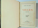
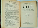
Villes, mémoires Rouen - Montmartre - Brest - Londres - Villes Rhénanes - Rome
Pierre Dumarchey, dit Pierre Mac Orlan, est un écrivain français, né le 26 février 1882 à Péronne et mort le 27 juin 1970 à Saint-Cyr-sur-Morin. Auteur d'une œuvre abondante et variée, il débuta par l'écriture de contes humoristiques, après avoir en vain tenté une carrière dans la peinture. Après la Première Guerre mondiale, son inspiration se tourna vers le registre fantastique et le roman d'aventures. La dernière partie de sa carrière littéraire fut consacrée à l'écriture de chansons, d'essais et de mémoires vol, in8, 200x140, relié demi cuir, frottements, dos râpé, très bel état intérieur, 262pp, couvertures d'origines conservées Paris Gallimard 1929 ref/109b
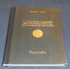
LA TUNISIE. PEUPLE ET HORIZON, AIMER, COMPRENDRE, CONNAÎTRE UN PAYS.
FRANCE LOISIRS. 1990. In-8. Cartonné. Bon état, Couv. convenable, Dos satisfaisant, Intérieur frais. 120 pages. Premier plat illustré en couleurs. Frontispice et nombreuses illustrations en couleurs dans et hors texte.. . . . Classification Dewey : 910-Géographie générale. Voyages
Classification Dewey : 910-Géographie générale. Voyages
Voyage Dans Les Trois Royaumes D'Angleterre, D'Ecosse, Et D'Irlande, faits en 1788 et 1789
Chez Briand | à Paris 1792 | 12.50 x 19.20 cm | 3 volumes reliés
Edition originale illustrée de 3 cartes dépliantes et 6 figures, le tout sur papier fort. Reliure en demi veau à petits coins d'époque. Dos à nerfs orné de 5 fleurons et de filets dorés. Pièces de titre et tomaison beiges. Traces de frottement sur les plats. Exemplaire bien frais. L'auteur s'est attaché à montrer les différences qui existent entre l'Angleterre, l'Ecosse et l'Irlande, il s'est particulièrement intéressé aux institutions philantropiques. Moeurs, coutumes, lois, constitutions, anecdotes historiques... - Photographies et détails sur www.Edition-Originale.com -


Phone number : 01 56 08 08 85
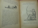
LA SCULPTURE ANTIQUE. l'Orient - La Grèce et l'Italie
illustrations in et hors texte vol relié in-8, 210x150, relié, dos percaline, bon état général, 352pp Paris Quantin 1889 ref/c26
Notre évacuation de Paris du 11 juin 1940
Non Précisé Vers 1950
Bon état Couverture cartonnée , dos toilé , format 27,5 X 21 cm , 77 pages . Récit dactylographié illustré de dessins . Témoignage de lauteur sur cette période , sa fuite de Paris en juin 40 , son périple à travers la France pour rejoindre Bassoues darmagnac en passant par Le mans , Argentan , Granville , Folligny , Beauchamps , Saint aubin daubigné , Rennes , Redon , Nantes , La roche sur yon , Rochefort , Saintes , Bordeaux , Montauban , Cahors , Agen , Auch et Mirande .Pierre Peyret conte son voyage en donnant souvent les noms des gens qui lont aidé dans chacune des villes traversées .Affectueux envoi de lauteur aux familles Faure et Falières de Tillac . - largeur/hauteur :x cm - poids : g - nombre de pages : p. - langue :
De Bayonne à Biarritz en Cacolet avec les poètes Gascons
1943, Imprimerie de “La Presse”, Bayonne. Plaquette in-8, 16pp. Infimes épidermures sur couverture, première et dernière page. Exemplaire satisfaisant
Description de l'Egypte. Mémoires sur le Nilomètre de l'île d'Eléphantine et les mesures égyptiennes, par M. P. S. Girard
Imprimerie Impériale | à Paris 1809 | 27 x 42.50 cm | relié
Edition originale, extraite de la première livraison de la description de l'Egypte, partie : Antiquités, Mémoires. Nombreuses notes en bas de pages. Un tableau représentant le système métrique des égyptiens sous les Ptolémées. Reliure en plein cartonnage crème parcheminée moderne. Pièce de titre en basane noire et titre doré. Très bel état, car l'exemplaire est tel que paru, à toutes marges, sur papier vélin. Le mémoire retrace la recherche du nilomètre sur l'Île Eléphantine, sa description et sa fonction, tant que l'importance de la découverte, puisque ce nilomètre, en plus de donner une histoire des crus du Nil, servait à élever les pyramide et les mesurer. L'auteur en infère une réflexion de système métrique des égyptiens, et des anciens. - Photographies et détails sur www.Edition-Originale.com -


Phone number : 01 56 08 08 85
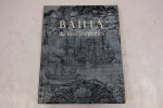
BAHIA de tous les poètes
1955, La Guilde Du Livre. In-8, broché, 102. Nombreuses photos en noir et blanc. État du livre est bon malgré des traces d’usures.
Outrepart. Anthologie d'Utopies, de Voyages extraordinaires et de Science fiction Textes du IIIe millénaire avant J.-C. à 1787
La Proue coll. la tête de feuilles, 10 mars 1971 - In-8°, br. couverture contrepliée souple glacée ill , 233 pages, très bel exemplaire.
Franco de port France jusqu'à 29 euros iclus. MONDIAL RELAY pour : FRANCE, Portugal, Pologne, Espagne, Allemagne, Autriche, Pays Bas, Luxembourg, Italie, Belgique. Toutes les étapes sont accompagnées. Achat, estimations et listages France / Suisse (sur rdv).
Exposition France-Belgique
Palais des Beaux-Arts, Lille, 1958. In-8, broché sous couverture illustrée en noir, 159 pp. - pl. Préface, par Jean Benedetti, préfet du Nord - Introduction, par Charles Braibant, directeur général des Archives de France - Catalogue : Les évêchés de la région du Nord, par P. Pietresson de Saint-Aubin - La civilisation monastique en France et ...
Avec 12 planches en noir et blanc en hors-texte. --- Plus d'informations sur le site archivesdunord.com
Phone number : 01 42 73 13 41
Le Transsibérien. La plus longue voie ferrée du Monde.
Fribourg, Office du Livre 1980, 320x250mm, 239pages, reliure d'éditeur sous jaquette. Bel exemplaire.
photos couleurs et n/b, Pour un paiement via PayPal, veuillez nous en faire la demande et nous vous enverrons une facture PayPal
Relation du premier voyage autour du monde par Magellan. 1519 - 1522. Commenté et transcrit d’après le manuscrit français par Léonce Peillard. Edition accompagnée de reproductions en couleurs de portulans portugais du XVIe siècle, d’un cahiers de documents, et de plusieurs cartes anciennes dont une en dépliant portant l’itinéraire du voyage.Collection Découverte de la Terre.
Paris, Club des Libraires de France 1956, 200x140mm, 469pages, reliure d'éditeur sous jaquette. Exemplaire sur alfa numéroté 5276/6000. Maquettes de Pierre Faucheux. Très bel exemplaire.
Pour un paiement via PayPal, veuillez nous en faire la demande et nous vous enverrons une facture PayPal
NOUVEAU VOYAGE DE FRANCE. Avec un itinéraire, et des cartes faites exprés, qui marquent exactement les routes qu'il faut suivre pour voyager dans toutes les provinces de ce royaume.Ouvrage également utile aux François & aux Etrangers. (en 2 parties).
Paris, chez Théodore Legras, 1724, 1 pleine basane, dos à nerfs, orné. in-8, 1 ff. blanc, XX-618 pp. + 2 feuillets de privilège et errata, 15 cartes dépliantes, ex-libris manuscrit ;
Phone number : 06 80 15 77 01
 Write to the booksellers