1 books for « teixeira luis ortel... »Edit
-
Topics
Abraham (1)
Azores (1)
Maps (1)
Navy (1)
Tea (1)
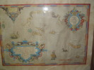
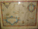
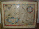
Published by Antwerpen, dat. 1584., Ortelius Abraham, 1584. Acores Insulae. Altkolorierte Kupfer-Karte aus Abraham Ortelius "Theatrum Orbis Terrarum". carte coloriée d’époque
1584 Orig. copper-engraving. Published by A. Ortelius after to L. Teixeira's map of the Açores. Dated 1584. Coloured. With title in decorative border, 3 ornamental cartouches, 2 ships, sea-monster and "Scala Leucarum". 32,5:46,5 cm (12 3/4 x 18 1/4 inch.) 2,5 x 46,5 cm Van der Krogt, Koeman's Atlantes Neerlandici, Vol. III B, 6350:31; Van den Broecke, Ortelius Atlas Maps, Nr. 24. - Stammt aus einer von fünf lateinischen Ausgaben, die in den Jahren 1595 - 1612 erschienen. Alle tragen das Datum 1584 in der großen Kartusche.A splendid sea chart of the Azores with three scrollwork cartouches; the ocean is decorated with sailing vessels. A fresh example of this scarce sea chart, based on Teixeira's single sheet map of Terceira from 1582, and a later manuscript atlas of the Azores islands. The Azores played a significant role in international sea trade as a victualling stop and shelter for ships sailing into the South Atlantic. In very good condition. The map was first issued in an edition of 100 examples in the Additamentum to the 1583 edition of Ortelius' Theatrum Orbis Terrarum, which is widely referred to as the first modern atlas and a landmark in the history of Western map making. Beginning in 1570, Abraham Ortelius and his successors published (and continuously added to) this monumental work for a period of over 40 years (not including the very rare edition of 1641), with text on the verso in Latin, Italian, German, Dutch, French, Spanish and English.References: Van Den Broecke 24. Meurs p 253-254.
Remise de 20% pour toutes commandes égales ou supérieures à 100 €
 Write to the booksellers


