25 books for « stanford edward »Edit
-
Type
Book (4)
Maps (21)
-
Century
19th (20)
20th (2)
-
Countries
Belgium (1)
China (1)
Denmark (1)
France (21)
Switzerland (1)
-
Syndicate
ILAB (22)
SLAM (21)
[GÉOLOGIE] Geological map of the British Isles.
London, Edward Stanford, [1896]. 610 x 480 mm.
Belle carte géologique des Îles Britanniques, dressée par le géologue Edward Best, comportant un index des couleurs pour les différents types de formations géologiques. Elle est issue du London Atlas of universal geography de Edward Stanford. En carton, les Shetland et les Orcades. Bel exemplaire en coloris de l'époque.
![[GÉOLOGIE] Geological map of the British Isles.. STANFORD (Edward).](https://static.livre-rare-book.com/pictures/LBW/lbw-2865_1_thumb.jpg)
[AFGHANISTAN & PAKISTAN] Map of the north western frontier of India showing the Pamir region and part of Afghanistan.
London, Edward Stanford, 1896. 470 x 640 mm.
Carte figurant le nord-ouest de l'Inde, avec la région du Pamir au Tadjikistan, le Pakistan et la moitié nord de l'Afghanistan jusqu'à Sar-é Pol à l'ouest et Kotwa au sud. Elle est issue du London Atlas of universal geography de Edward Stanford. Au nord, la carte s'étend jusqu'à Chinaz en Ouzbékistan, et à l'est jusqu'à la région du Xinjiang en Chine. Elle montre la frontière de l'Afghanistan déterminée lors de l'accord anglo-russe de 1872-73. L'accord anglo-russe de 1873 concernant une zone tampon en Asie centrale fut conclu à la suite de négociations entre les gouvernements russe et britannique d'octobre 1872 à janvier 1873. Il définit les sphères d'influence russe et britannique en Asie centrale et établit les frontières nord de l'émirat afghan. La carte montre également la frontière administrative de la Russie et la frontière politique britannique. Les altitudes en pieds sont indiquées pour toutes les villes et montagnes. Bel exemplaire en coloris de l'époque.
![[AFGHANISTAN & PAKISTAN] Map of the north western frontier of India showing the Pamir region and part of Afghanistan.. STANFORD (Edward).](https://static.livre-rare-book.com/pictures/LBW/lbw-6821_1_thumb.jpg)
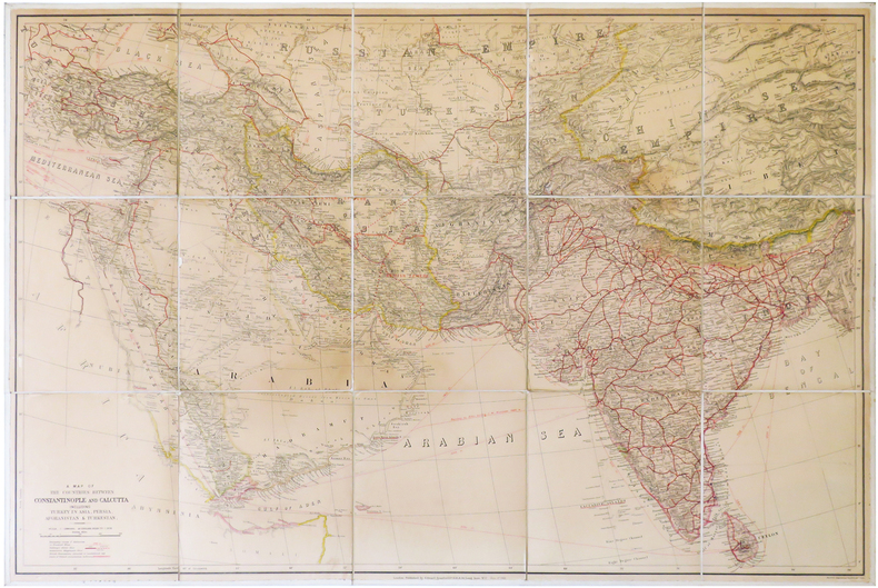
A Map of the countries between Constantinople and Calcutta including Turkey in Asia, Persia, Afghanistan & Turkestan.
London, Edward Stanford, 1912. En 15 sections montées sur toile et pliées, formant une carte de 0,68 x 1,02 m.
Grande carte dressée par Edward Stanford, figurant la région comprise entre Constantinople, capitale de l'Empire ottoman, et l'Inde britannique, avec la Turquie, la Perse, l'Afghanistan et le Turkestan. Les possessions britanniques sont coloriées ou soulignées en rouge, et comprennent l'Inde britannique, Chypre, le protectorat d'Aden (actuel Yémen), l'île de Socotra (Yémen), ainsi que quelques villes situées le long du littoral de la Corne de l'Afrique. À l'est du Bhoutan figure un territoire dont il n'a pas été fait de levé géographique, et habité par des tribus indigènes. La carte montre également les sphères d'influence russe et britannique en Iran. Les lignes de chemin de fer et les câbles télégraphiques sous-marins sont également indiqués. Les routes et distances des bateaux sont notées en miles. Bon exemplaire. Deux petits manques aux sections 7 et 8.
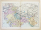
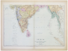
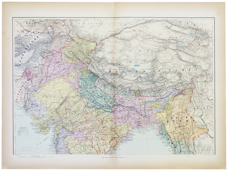
India and the adjacent parts of Beluchistan, Afghanistan, Turkestan, the Chinese empire, and Siam.
London, Edward Stanford, [1896]. En deux feuilles non jointes pouvant former une carte de 801 x 676 mm.
Belle carte de l'Inde et des régions voisines, issue du London Atlas of universal geography de Edward Stanford. Bel exemplaire en coloris de l'époque.

[CEYLAN/SRI LANKA] Ceylon.
London, Edward Stanford, [1896]. 640 x 503 mm.
Belle carte de l'île de Ceylan, issue du London Atlas of universal geography de Edward Stanford. Déchirure dans la partie gauche de la carte restaurée. Exemplaire en coloris de l'époque.
![[CEYLAN/SRI LANKA] Ceylon.. STANFORD (Edward).](https://static.livre-rare-book.com/pictures/LBW/lbw-2872_2_thumb.jpg)
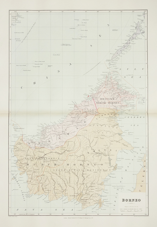
Borneo.
London, Edward Stanford, [1896]. 610 x 406 mm.
Belle carte figurant l'île indonésienne de Bornéo, avec la partie britannique coloriée en rose. Au nord on peut voir l'île de Palawan. La carte est issue du London Atlas of universal geography de Edward Stanford. Bel exemplaire en coloris de l'époque.

[ARGENTINE] The Argentine Republic. Chile, Paraguay, Uruguay.
London, Edward Stanford, [1896]. 660 x 500 mm.
Carte issue du London Atlas of universal geography de Edward Stanford. Bel exemplaire en coloris de l'époque.
![[ARGENTINE] The Argentine Republic. Chile, Paraguay, Uruguay.. STANFORD (Edward).](https://static.livre-rare-book.com/pictures/LBW/lbw-2879_1_thumb.jpg)
[CANARIES] The Canary Islands (Spanish).
London, Edward Stanford, [1896]. 480 x 622 mm.
Belle carte des Îles Canaries, montrant les lignes de télécommunications sous-marines, issue du London Atlas of universal geography de Edward Stanford. Bel exemplaire en coloris de l'époque.
![[CANARIES] The Canary Islands (Spanish).. STANFORD (Edward).](https://static.livre-rare-book.com/pictures/LBW/lbw-2867_2_thumb.jpg)
[MADERE] The Island of Madeira (Portuguese).
London, Edward Stanford, [1896]. 322 x 406 mm.
Belle carte de l'île portugaise de Madère, montrant les lignes de brasse et les lignes de télécommunications sous-marines, issue du London Atlas of universal geography de Edward Stanford. Bel exemplaire en coloris de l'époque.
![[MADERE] The Island of Madeira (Portuguese).. STANFORD (Edward).](https://static.livre-rare-book.com/pictures/LBW/lbw-2868_2_thumb.jpg)
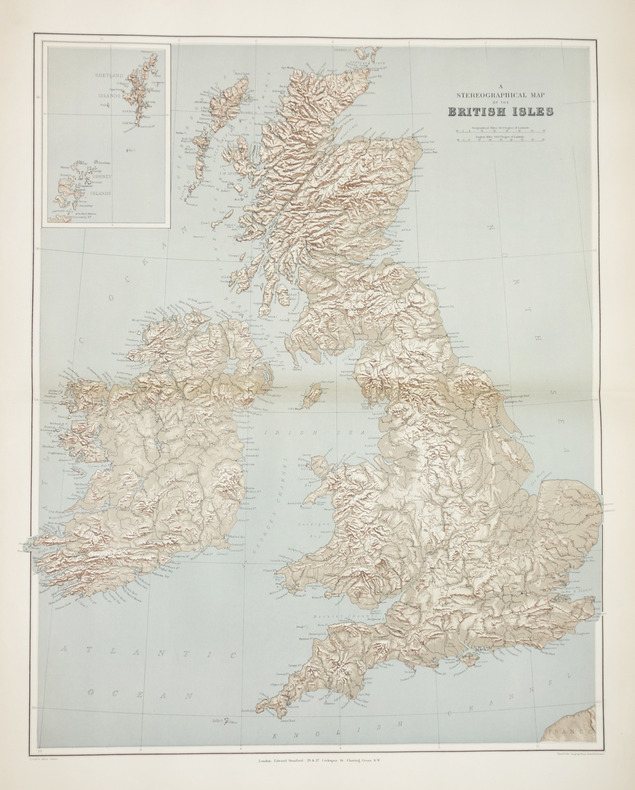
A stereographical map of the British Isles.
London, Edward Stanford, [1896]. 605 x 478 mm.
Carte issue du London Atlas of universal geography de Edward Stanford. En carton, les Shetland et les Orcades. Bel exemplaire en coloris de l'époque.

[FALKLAND/MALOUINES] The Falkland Islands.
London, Edward Stanford, [1896]. 520 x 630 mm.
Belle carte figurant les îles Falkland ou Malouines, levée par le capitaine Fitz Roy qui voyagea avec Charles Darwin à bord du HMS Beagle, entre 1831 et 1836, issue du London Atlas of universal geography de Edward Stanford. Bel exemplaire en coloris de l'époque.
![[FALKLAND/MALOUINES] The Falkland Islands.. STANFORD (Edward).](https://static.livre-rare-book.com/pictures/LBW/lbw-2880_2_thumb.jpg)
[Plan de Londres].
London, Edward Stanford, [1896]. En quatre feuilles séparées, chacune environ 350 x 505 mm.
Très beau plan détaillé de Londres en 4 feuilles non destinées à être jointes, issu du London Atlas of universal geography de Edward Stanford. Bel exemplaire en coloris de l'époque.
![[Plan de Londres].. STANFORD (Edward).](https://static.livre-rare-book.com/pictures/LBW/lbw-2866_1_thumb.jpg)
![[Plan de Londres].. STANFORD (Edward).](https://static.livre-rare-book.com/pictures/LBW/lbw-2866_2_thumb.jpg)
![[Plan de Londres].. STANFORD (Edward).](https://static.livre-rare-book.com/pictures/LBW/lbw-2866_3_thumb.jpg)
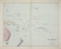
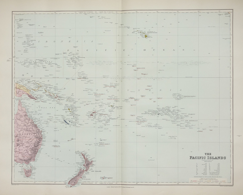
The Pacific islands on Mercator's projection.
London, Edward Stanford, [1896]. 480 x 603 mm.
Très belle carte du Pacifique, dressée sur la projection dite de Mercator, indiquant les atolls, les volcans en activité, les récifs coralliens émergés, les îles et atolls volcaniques, etc, avec un système de couleurs permettant de distinguer les possessions britanniques, françaises, allemandes, espagnoles et hollandaises. Elle est issue du London Atlas of universal geography de Edward Stanford. Bel exemplaire en coloris de l'époque.
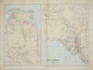
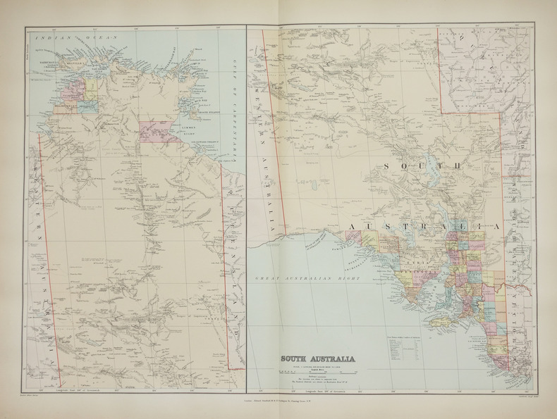
South Australia.
London, Edward Stanford, [1896]. 482 x 659 mm.
Belle carte figurant la partie est de l'Australie, correspondant aux états du Territoire du Nord, de l'Australie méridionale, du Queensland, de la Nouvelle Galles du Sud et de Victoria. Elle est issue du London Atlas of universal geography de Edward Stanford. Bel exemplaire en coloris de l'époque.
[ÎLES IONIENNES & MALTE] Map of the Ionian Islands and Malta.
London, Edward Stanford, [1896]. 630 x 540 mm.
Belle carte figurant les Îles Ioniennes de Corfou, Paxos, Sainte-Maure (actuelle Leucade), Itha que, Céphalonie, et Zante ou Zakynthos. En carton, les îles de Malte et de Gozo, l'île ionienne de Cythère ou Cerigo, et une carte de la Méditerranée montrant les principales routes à partir de Londres vers Bombay. La carte est issue du London Atlas of universal geography de Edward Stanford. Bel exemplaire en coloris de l'époque.
![[ÎLES IONIENNES & MALTE] Map of the Ionian Islands and Malta.. STANFORD (Edward).](https://static.livre-rare-book.com/pictures/LBW/lbw-2869_2_thumb.jpg)
[BIRMANIE] Burma and adjacent countries.
London, Edward Stanford, [1896]. 720 x 520 mm.
Belle carte figurant la Birmanie ou Myanmar et le sud du Bangladesh, issue du London Atlas of universal geography de Edward Stanford. Bel exemplaire en coloris de l'époque.
![[BIRMANIE] Burma and adjacent countries.. STANFORD (Edward).](https://static.livre-rare-book.com/pictures/LBW/lbw-2871_1_thumb.jpg)
[TASMANIE & FIDJI] Tasmania - Fiji archipelago.
London, Edward Stanford, [1896]. 539 x 308 mm.
Cartes figurant la Tasmanie et l'archipel des Fidji, issue du London Atlas of universal geography de Edward Stanford. Bel exemplaire en coloris de l'époque.
![[TASMANIE & FIDJI] Tasmania - Fiji archipelago.. STANFORD (Edward).](https://static.livre-rare-book.com/pictures/LBW/lbw-2744_2_thumb.jpg)
[NOUVELLE-ZÉLANDE] New Zealand.
London, Edward Stanford, [1896]. 606 x 470 mm.
Très belle carte de la Nouvelle-Zélande, indiquant la ligne de télécommunications sous-marines avec Sydney en Australie, les lignes de chemins de fer, les phares, glaciers, etc. Elle est issue du London Atlas of universal geography de Edward Stanford. Bel exemplaire en coloris de l'époque.
![[NOUVELLE-ZÉLANDE] New Zealand.. STANFORD (Edward).](https://static.livre-rare-book.com/pictures/LBW/lbw-2760_2_thumb.jpg)
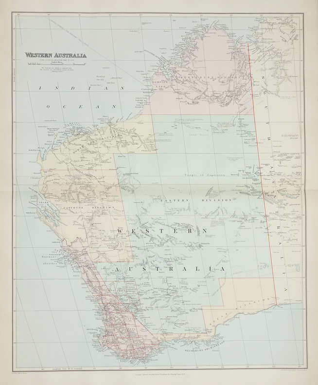
Western Australia.
London, Edward Stanford, [1896]. 508 x 628 mm.
Belle carte figurant la partie ouest de l'Australie, correspondant à l'état de l'Australie-Occidentale ou Western Australia, issue du London Atlas of universal geography de Edward Stanford. Bel exemplaire en coloris de l'époque.

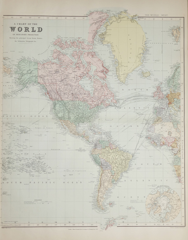
A Chart of the World on Mercator's projection.
London, Edward Stanford, [1896]. En deux feuilles non jointes pouvant former une carte de 0,66 x 1,07 m.
Belle mappemonde à projection plane dite de Mercator, montrant les itinéraires des transports maritimes et les lignes de télécommunications sous-marines, et illustrée de deux petites cartes de l'Arctique et de l'Antarctique. La carte est issue du London Atlas of universal geography de Edward Stanford. Bel exemplaire en coloris de l'époque.


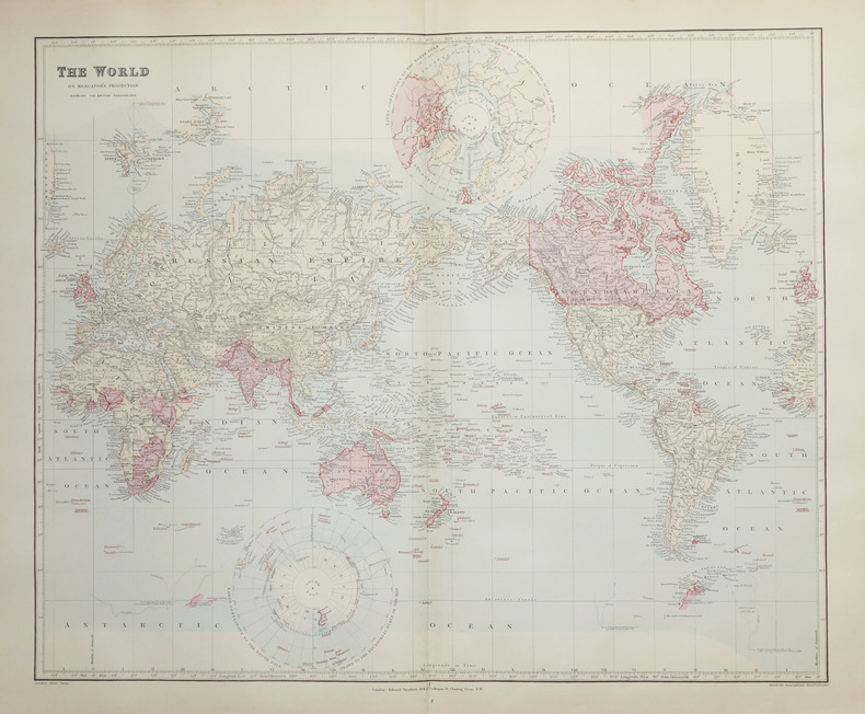
The World on Mercator's projection showing the British possessions.
London, Edward Stanford, [1896]. 496 x 603 mm.
Belle mappemonde à projection plane dite de Mercator, montrant toutes les possessions britanniques aquarellées en rose. La carte est issue du London Atlas of universal geography de Edward Stanford. Bel exemplaire en coloris de l'époque.
Complete Atlas of China - Containing separate Maps of the Eighteen Provinces of China Proper on the scale of 1:3,000,000 and of the Four Great Dependencies on the scale of 1: 7,500,000 together with an Index to all the Names on the Maps with the Latitude and Longitude of each Place, all Railways, Telegraph Stations, Ports & Protestant Mission Stations Marked - Second Edition prepared by Mr Edward Stanford for The China Inland Mission.
The China Inland Mission, London,Philadelphia, Toronto, Melbourne, Shanghai, 1917 (second edition). 1 volume folio, v-22 pp. (maps) - 16 pp. (index), with 22 large double-page colour maps, rebound in modern full leather, a very good copy .
A rare chinese atlas from early twenty century, in very good condition.
CARTE GEOGRAPHIE NOSTALGIQUE BNF - LES REGIONS ANTARCTIQUES
RELIEFS EDITIONS
LIVRE A L’ETAT DE NEUF. EXPEDIE SOUS 3 JOURS OUVRES. NUMERO DE SUIVI COMMUNIQUE AVANT ENVOI, EMBALLAGE RENFORCE. EAN:9782380361018
Map of the Mediterranean Sea.
.: London, Edward Stanford Ltd, 1923, 23 x15 cm, mounted on cloth, in 30 folding sections, coloured map 67.5 x 140 cm, in publisher's cloth with a printed label on front cover. (One pen marking on map).
Brazil from official and other Sources prepared in the international Bureau of the American Republics, Williams C. Fox, Director.
London, Edward Stanford, 1905. (95 x 95,5 cm.). A large lithographed map of Brazil, lithographed in colours, original linen-backed and folded in 35 sections. Folded in the original cloth-case with the original printed title-label preserved. A fine copy.
 Write to the booksellers
![[GÉOLOGIE] Geological map of the British Isles.. STANFORD (Edward).](https://static.livre-rare-book.com/pictures/LBW/lbw-2865_1.jpg)


![[AFGHANISTAN & PAKISTAN] Map of the north western frontier of India showing the Pamir region and part of Afghanistan.. STANFORD (Edward).](https://static.livre-rare-book.com/pictures/LBW/lbw-6821_1.jpg)
![[CEYLAN/SRI LANKA] Ceylon.. STANFORD (Edward).](https://static.livre-rare-book.com/pictures/LBW/lbw-2872_2.jpg)
![[ARGENTINE] The Argentine Republic. Chile, Paraguay, Uruguay.. STANFORD (Edward).](https://static.livre-rare-book.com/pictures/LBW/lbw-2879_1.jpg)
![[CANARIES] The Canary Islands (Spanish).. STANFORD (Edward).](https://static.livre-rare-book.com/pictures/LBW/lbw-2867_2.jpg)
![[MADERE] The Island of Madeira (Portuguese).. STANFORD (Edward).](https://static.livre-rare-book.com/pictures/LBW/lbw-2868_2.jpg)
![[FALKLAND/MALOUINES] The Falkland Islands.. STANFORD (Edward).](https://static.livre-rare-book.com/pictures/LBW/lbw-2880_2.jpg)
![[Plan de Londres].. STANFORD (Edward).](https://static.livre-rare-book.com/pictures/LBW/lbw-2866_1.jpg)
![[ÎLES IONIENNES & MALTE] Map of the Ionian Islands and Malta.. STANFORD (Edward).](https://static.livre-rare-book.com/pictures/LBW/lbw-2869_2.jpg)
![[BIRMANIE] Burma and adjacent countries.. STANFORD (Edward).](https://static.livre-rare-book.com/pictures/LBW/lbw-2871_1.jpg)
![[TASMANIE & FIDJI] Tasmania - Fiji archipelago.. STANFORD (Edward).](https://static.livre-rare-book.com/pictures/LBW/lbw-2744_2.jpg)
![[NOUVELLE-ZÉLANDE] New Zealand.. STANFORD (Edward).](https://static.livre-rare-book.com/pictures/LBW/lbw-2760_2.jpg)
