10 books for « isaak tirion »Edit
-
Type
Book (3)
Maps (7)
-
Topics
Maps (7)
North america (5)
West indies (1)
-
Syndicate
ILAB (10)
SLAM (7)
De twee groote Synagogen der Hoogduitsche Jooden en het Oude-Zyds-Huiszitten-Aalmoesseniers-Huis van agteren, in 't verschie
Amsterdam Isaak Tirion 1765
An attractive view of the synagogues in Amsterdam, by Isaak Tirion after Jan de Beijer. Published by Isaak Tirion as part of Jan de Wanenaar's "Amsterdam in its rise, growth, histories,..," ("Amsterdam in zyne opkomst, aanwas, geschiedenissen,.etc.,"). engraved area is 21cm x 38cm. Page is 43cm x 51cm. First edition. Also elsewhere attributed to the publisher Fouquet as part of his Atlas Van Fouquet. However, the dimensions of the plate and page make the Tirion edition correct.
Verklaring van Mozes Derde Boek, Genoemd Levitikus uit de Engelsche verklaringen van de heeren Patrik Polus, Wels.
Amsterdam Isaak Tirion en Jacobus Loveringh 1740 Eerste druk. [Gebonden met], Verklaring van Mozes vierde boek, genoemd Numeri. Bovenaan de achterkant staat een mooie kaart van de reis van de Israëlieten van Egypte naar Kanaän door Isaak Tirion. Twee delen gebonden als één boek. Wit leer (lijkt geen perkament te zijn) met reliëf ontwerp op het voor- en achterplat. titels geïnkt op de rug. klein ex libris gestempeld op het voorste schutblad. De teksten zijn in goede, schone staat met een lichte verkleuring van het papier. Beide delen zijn 1e drukken. Commentaar op deze twee boeken van de Bijbel. Beide delen hebben een halve titel en een titelpagina gedrukt in rood en zwart met een vignet illustratie. Er is ook een aantrekkelijke gravure op de eerste tekstpagina van elk deel. Een klein beetje slijtage aan de bovenkant van de eerste titel. Johann van den Honert was een 18e eeuwse Nederlandse theoloog die een van de belangrijkste protestantse hervormers in Nederland was. Honert was een aanhanger van het orthodoxe calvinisme LXVI, 342, [8], 390 + kaart 260 x 210 mm
First edition. [Bound with], Verklaring van Mozes vierde boek, genoemd Numeri. Top the rear is a fine map of the journey of the Israelites from Egypt to Canaan by Isaak Tirion. Two volumes bound as one. White leather (doesn't seem to be vellum) embossed design to the front and rear board. titles inked to the spine. small ex libris stamped to the front end paper. The texts are in good clean condition with just a touch of darkening to the paper. Both volumes are First Editions. Commentary on these two books of the Bible. Each has a half title, and a title page printed in red and black with a vignette illustration. There is also an attractive engraving to the first text page of each volume. A touch of edgewear to the top of the first title. Johann van den Honert was an 18th century Dutch theologian who was one of the most important Protestant reformers in the Netherlands. Honert was a supporter of orthodox Calvinism LXVI, 342, [8], 390 + map 260 x 210 mm (10Πx 8Πinches). .
[GREAT BRITAIN] HEDENDAAGSCHE HISTORIE, Of Tegenwoordige Staat Van Groot Brittannie. [Vol. I-II] Vervattende Eene Beschryving van 's Lands Gelegenheid.
Amsterdam Isaak Tirion 1754
1754-1755. Four Parts in two volumes: With two different engraved frontispieces by J.C. Philips, six folding engraved maps by Isaak Tirion. (Including "Nieuwe Kaart van de Eilanden van Groot Brittannien behelzende De Koningryken Engeland, Schotland en Ierland [..]", ca. 32,5 x 37,5 cm.; "Nieuwe Kaart van Ierland", ca. 34 x 27,5 cm. & "NIEUWE KAART VAN DE GROOTBRITTANNISCHE VOLKPLANTINGEN IN NOORD AMERICA [..]", ca. 36,5 x 45,5 cm.), 1 fold. engraved map of London & surroundings ("Kaart van Londen [..]", ca. 28 x 41,5 cm.). The are also 6 folding engraved views (of London) by J.C. Philips et al. including 1 which depicts 2 views of London. There is also an engraved portrait of King George II by J. Houbraken after A. Schouman. 8vo (ca. 20 x 12 cm.), 18th century uniform gilt calf, gilt ribbed spine with 2 contrasting labels with titles, marbled edges. A profusion of gilt to the spines! Both vols possibly lack a divisional title (of the second part), but texts are complete. A few minor imperfections (foot of spine of vol. I slightly damaged / chipped, bindings slightly rubbed/ worn along extremities, 1 fold. map. slightly torn in outer blank margin, a little foxed/ browned), but nevertheless an attractively bound set in good condition. [6],368,[2],369-712,[12 index] and [4],348,[6],349-684,[24 index] pp. 200 by 125mm (7Ÿ by 5 inches). Tiele (Ned. Bibliographie van Land- en Volkenkunde) 1033. Complete set of an 18th-cent. topographical description of Great Britain including a description of the former British colonies in NORTH AMERICA (pp. 658-684, titled "Tegenwoordige Staat Van De Groot Brittannische Bezittingen In Noord-Amerika, En in andere Weerelsdeelen").
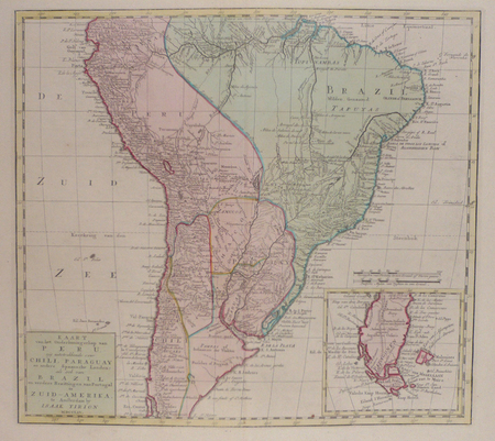
Kaart van het onderkoningschap van Peru, ... Chili, Paraguay ... Brazil ... in Zuid-Amerika.
Amsterdam, 1765. 360 x 398 mm.
Très bel exemplaire brillamment colorié à l'époque. En carton en bas à droite dans un encadré, carte détaillée de la Patagonie et de la Terre de Feu.

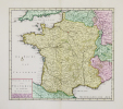
Nieuwe kaart van Frankryk.
Amsterdam, [circa 1730]. 329 x 375 mm.
Belle carte de la France aquarellée à l'époque.

[MARTINIQUE] Het westindisch eiland Martenique.
Amsterdam, [circa 1760]. 309 x 368 mm.
Belle carte de la Martinique divisée en Basse-Terre, occupée par les Français, et Cabesterre, occupée par les Caraïbes. Ce partage physique et ethnique de l'île intervint en 1639. La Basse-Terre s'étendait approximativement entre l’actuelle Basse-Pointe et Sainte-Luce. La carte est ornée d'un cartouche de titre décoré de plants de canne à sucre. Bel exemplaire. Infimes rousseurs marginales.
![[MARTINIQUE] Het westindisch eiland Martenique.. TIRION (Isaak).](https://static.livre-rare-book.com/pictures/LBW/lbw-4527_2_thumb.jpg)
[PANAMA] Kaart van de landengte van Panama.
Amsterdam circa 1760 270 x 303 mm.
Belle carte figurant l'isthme de Panama avec les provinces de Panama et de Colon. Y figurent les deux villes principales de Panama et Portobelo, ainsi que Nombre de Dios, Pequeni, San Juan ou encore Cruces. Au large de la ville de Panama figurent les îles Ottoquillo, Perigo et Flamenco. Les principales rivières sont nommées, ainsi que le fleuve Chagres. Bel exemplaire finement colorié à l'époque.
![[PANAMA] Kaart van de landengte van Panama.. TIRION (Isaak);](https://static.livre-rare-book.com/pictures/LBW/lbw-1366_1_thumb.jpg)
[BRESIL] Kaart van de aller-heiligen baay waar aan de Hoofdstad legt van Brazil.
Amsterdam circa 1760 344 x 407 mm.
Carte figurant la Baie de Tous les Saints ou Baia de Todos os Santos, avec la ville de Salvador de Bahia et l'île d'Itaparica. En bas à droite, plan de la ville de Salvador. Bel exemplaire finement colorié à l'époque.
![[BRESIL] Kaart van de aller-heiligen baay waar aan de Hoofdstad legt van Brazil.. TIRION (Isaak);](https://static.livre-rare-book.com/pictures/LBW/lbw-1307_1_thumb.jpg)
Nieuwe kaart van het westelykste deel der weereld ... naar Westindie.
Amsterdam 1754 340 x 362 mm.
Carte gravée du continent américain. Très bel exemplaire brillamment aquarellé à l'époque.
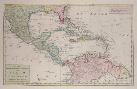
Kaart van de onderkoningschappen van Mexico en Nieuw Granada in de Spaansche West-Indien.
Amsterdam 1765 298 x 476 mm.
Carte gravée du Mexique et de l'Amérique centrale. Très bel exemplaire brillamment colorié à l'époque.

 Write to the booksellers


![[MARTINIQUE] Het westindisch eiland Martenique.. TIRION (Isaak).](https://static.livre-rare-book.com/pictures/LBW/lbw-4527_2.jpg)
![[PANAMA] Kaart van de landengte van Panama.. TIRION (Isaak);](https://static.livre-rare-book.com/pictures/LBW/lbw-1366_1.jpg)
![[BRESIL] Kaart van de aller-heiligen baay waar aan de Hoofdstad legt van Brazil.. TIRION (Isaak);](https://static.livre-rare-book.com/pictures/LBW/lbw-1307_1.jpg)


