2 books for « gibbon lardner »Edit
-
Countries
Denmark (1)
Switzerland (1)
Gibbon's report.
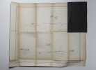
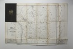
U.S. Government, 1854. Deux cartes rempliées sous percaline maron estampée à froid, titre doré.
Il s'agit des cartes illustrant le voyage de Gibbon au Brésil. La première est intitulée Map of the Andes (43 x 50 cm) et la seconde Map Drawn by Lieut. Lardner Gibbon to Accompany His Report (47 x 70 cm), une belle carte de l'Amérique du Sud comprenant la Bolivie, certaines parties du Brésil, l'Argentine et le Pérou. Comprend un encart latéral du Rio Mamore dans le nord de la Bolivie à Rio Madeira à Rio Amazon. Menus défauts. Du vendredi 18 au mercredi 23 l'activité du libraire sera au ralentie quant aux interactions sur internet. La librairie sera fermée vendredi 18 et lundi 21 avril.
Exploration of the Valley of the Amazon, made under the Direction of the Navy Department. Part I-II. (Part I by Lieut. Herndon. II. By Lt. Lardner Gibbon). 2 Vols.
Washington, Robert Armstrong (and A.O.P. Nicholson), 1853-54. Volume I bound in orig. full cloth, spine faded, skall tears on hinges, light wear to spine-ends. Volume II bound in contemp. full calf., titlelabels with gilt lettering. Spine-ends repaired. Rubbed. 414,IV pp. a. 15 (of 16) tinted lithographed plates. + X,(2),339 pp., 36 tinted lithographed plates and 2 folded maps (one map with a tear, repaired on verso). In volume I on front free endpaper a dedication ""Captain Rothe/ from Lieu/tnt Maury"" - Matthew Fontaine Maury ??
 Write to the booksellers


