See also : Paris
1 books for « empire de russie de ... »Edit
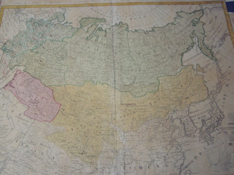
Carte de l'Empire de Russie & de la Grande Tartarie dressee avec soin par F. L. Gussefeld & publiee par les Herit. de Homann, l'an 1786
1786 CHARTE DAS RUSSISCHE REICH UND DIE VON DEN TATARN BEWOHNTE LANDER IN EUROPA UND ASIA ENTHALTEND. Entworfen von F. L. Gussefeld. Engraved map of the Russian and Tatar Empires. Hand colored, with decorative corner cutaway with scales and numerical legend for the governmental regions of Russland. Intricately illustrated cartouche. surtitled "Carte de l'Empire de Russie & de la Grande Tartarie dressee avec soin par F. L. Gussefeld & publiee par les Herit. de Homann, l'an 1786."46.5 X 61 cm,pli central avec legere fente,coloriée,bonnes marges haut et bas.
Remise de 20% pour toutes commandes égales ou supérieures à 100 €
 Write to the booksellers


