London, printed by George Bigg: sold by P. Elmsly, and Mr. Chapman, 1791-1793 & London, Ballentine and Law, 1808. Folio (313 x 233 mm). 2 volumes uniformly bound in recent half calf with five raised bands and gilt lettering and ornamentation to spines.Vol. 1: With repair to upper inner corner of general title-page. Title-page to “A Plan for a Publication of a Repertory” with vague illegible blind-stamp. 1 plate (Map of the Ava River) mounted in lower inner part. Plates with light brownspotting, otherwise internally fine and clean.(2) pp., pp. (1)-4, (i)-iv [Introduction to the first number, 9th April 1791], (1)-4 [Introduction, January 1791], (2)pp. [Dedication], pp. (i)-iv [Introduction to the second number], (i)-iv [Introduction to the third number], (i)-iv [Introduction to first number, 31st December 1792], (4)pp., pp. 2-576, 577-578, 577-578, (16) [Register] pp. + 16 plates as called for. Vol. 2: Title-page with vague blind stamp. First leaf of introduction to first number with repairs to inner and lower margin, slightly affecting text. ‘Map of part of the Nothern Cicars’ with two large tears almost splitting the map. Plates with browning. Text fine and clean throughout.(4) pp., pp. (i)-iv [Introduction to first number], (i)-iv [Introduction to second number], (1)-4 [Introduction to the third number], (1)-4 [Introduction to the fourth number], (4) pp., pp.(1)-600, (16) [register] pp. + 17 plates as called for.
First edition, first issue of the complete volumes, printed in 250 copies, on the history, geography, and ethnography of the East Indies consisting mostly of reports, charts and translations produced by agents of the East India Company, including Dalrymple himself, nearly all previously unpublished. His editorial activity in searching out and publishing contributions was a private interest, in addition to his work for the East India Company and later also for the Admiralty. Dalrymple’s publications are notoriously famous for their bibliographical complexities. “Many published items went through different editions, issues or states during a long period of currency."" (Cook) – This work is no exception. Our set corresponds to Cook A192 and A251 (Cook, Catalogue of Dalrymple’s Letterpress Publications). “Between April 1791 and 1797 Dalrymple published 1100 quarto pages and more than thirty plates, in eight numbers of his Oriental Repertory, on the history, geography and ethnography of the East Indies. His editorial activity in searching out and publishing contributions was a private interest, in addition to his work for the East India Company and later also for the Admiralty. In November 1790 Dalrymple issued his prospectus for a new publishing venture, removed in style and content from his nautical publications but akin to the antiquarianism of his geographical works. He proposed an occasional publication in parts, cumulating in volumes for the subscriber's library, each with a variety of short communications illustrated by topographical plates. He saw a place, among the scientific and antiquarian Journals and 'gentlemen's magazines' of England and India, for such a vehicle on oriental matters. Asiatick Miscellany (1785-1788) and Asiatick Researches (1788 onwards) were fresh on the scene, the latter for more substantial articles as the organ of the Asiatic Society of Bengal.” (Cook) The Plan, and the advance 'introduction' which accompanied it as a prospectus after January 1791, crystallised in the first number of Oriental Repertory in April of that year. Four Astronomical observations were admitted, linked to 'Geography'. 'Meteorology, or account of Weather and Seasons' appeared as a separate category. 'Commerce' was expanded to 'Commerce and Manufactures'. 'Manners' was three times amplified, culminating in 'Of the Indians, comprehending their Literature, Sciences, Arts, Manners, Customs and Religion'. Natural history was first grouped with History, but later placed alone. Beside 'Miscellaneous, as History, &c. ', a series of geographical headings supplemented the six subject divisions for countries outside India. The examples Dalrymple gave for geographical headings reflected, not unnaturally, his own interests: Ava and Pegu, Cochin-China, China, Oriental-Polynesia, &c. From the beginning he intended to devote his contributions to the documents he had collected on south-east Asia. particularly in the Madras records between 1757 and 1759, when he was already searching for background information for his Sulu Islands trading project, and documents on embassies to Burma and Indo-China. “The first introduction proposed a complex system of pagination to allow subscribers to bind their collections of tracts according to the proposed subject classes. The bottom inner corner of each page would show the running title of the class, the bottom outer corner the separate paging of each tract. This was in addition to the alphabetical 249 register -('the literal numeration of the whole collection') at bottom - centre, and the general paging of the volume at top centre. While each tract in the main classes was to have its own subsidiary paging, a single sequence of subsidiary page numbers was to run through the volume for 'Miscellaneous', which were not intended to be sold as separate tracts. Changes were made in the second version of the introduction, which shows disconnected examples of The class running title and class page numbering above the Inner margin in the running title line. The final version of the introduction quietly dropped all idea of the separate sale of individual tracts, and moved the class title and numbering to a subsidiary position in the left margin of each page. No example is known of any part of Oriental Repertory rebound by classes. “(Cook). There was no speedy conclusion to the second volume. Eleven more years elapsed before Dalrymple turned again to Oriental Repertory, in the last year of his life, to complete the second volume by a series of expedients. Instead of issuing the promised full fifth part to complete volume 11, he prepared an extremely short substitute: twenty-four pages of new text, with indexes, tables of contents, and a volume title-page for 256 surviving subscribers to match the 1793 title to volume 1. According to the title-page ('Volume II in five parts'), this was the fifth part, but in the table of contents it was subsumed as the conclusion of the halfsize fourth number begun in 1797. The symmetry of four 'numbers' in each volume was therefore maintained everywhere except on the subscribers' title-page. No editorial statement appeared on the completion of volume 11 to indicate Dalrymple's sense of his own achievement. The value of Oriental Repertory, apart from its content, is to indicate the subjects and areas of interest uppermost in Dalrymple's mind at different times as unfinished business. Collections of Dalrymple's charts, views, plans, and memoires, as they survive today, vary wide in composition: ""There is not single comprehensive collection, embracing all Dalrymple's publications over a forty-year period, which can be used as 'control' to establish Dalrymple's Oeuvre. Many published items went through different editions, issues or states during a long period of currency."" (Cook) Alexander Dalrymple (1737-1808) is now generally regarded as the originator of Official British hydrography (Cook). He was the main proponent of the theory that there existed a vast undiscovered continent in the South Pacific, Terra Australis Incognita. He produced thousands of nautical charts, mapping a remarkable number of seas and oceans for the first time, and contributing significantly to the safety of shipping. His theories prompted a number of expeditions in search of this mythical land, until James Cook's second journey (1772-1775) led to the conclusion that, if it did exist, it was further south than the 65° line of latitude South. Dalrymple's activities in his nautical publications can, however, be devided into four distinct periods: 1, His voyages in the Eastern Archipelago (1769-1772), the present publication belonging to this period. 2, the private publication of charts and plans with grants or subscriptions from the East India Company (1772-1779) [To which the present publication belongs]. 3, the annual series of charts, plans, views and memoirs issued from 1779 onwards for the East India Company. 4, the organization and output of the Admiralty Hydrographic Office which he ran in parallel with his East India Company work after 1795. Cook A192 and A251.
APRÈS de MANNEVILLETTE (Jean-Baptiste-Nicolas-Denis d') & DALRYMPLE (Alexander).
Reference : LBW-4998
(1775)
[1775-1781]. 333 x 484 mm.
Belle carte marine figurant les côtes de la Chine, et carte très importante pour la cartographie de Hong Kong. Elle a été dressée par Alexander Dalrymple d'après les observations faites à bord du senau le Goudelours et du vaisseau le Londres en 1754, 1759 et 1760. Elle s'étend à l'ouest jusqu'à Macao. Au centre, Hong Kong est identifiée sous le nom de Fanchinchow, avec les îles de Lamma, de Po Toi orthographiée Poo-Toy, et de Dangan appelée Gde Lema. La carte est traversée de lignes de rhumb permettant aux vaisseaux de maintenir leur cap. La carte est issue du Neptune Oriental, publié entre 1775 et 1781. Cet atlas, composé de grandes cartes nautiques, de cartes détaillées de parties de côtes ou d’entrées de port, était accompagné d’instructions nautiques nécessaires à la navigation entre l’Europe et l’Asie. On y trouve plus particulièrement des cartes nouvelles de Madagascar, Sumatra, Java, des Philippines et de la Chine. L’ouvrage valut une grande renommée à son auteur car il comblait les nombreuses lacunes des cartes hollandaises. Jean-baptiste d’Après de Mannevillette fut un hydrographe et capitaine de vaisseau au service de la Compagnie des Indes. En 1745, la première édition du Neptune Oriental, fruit de 12 années de travail, le rendit célèbre. Trente ans plus tard, en 1775, il publia une seconde édition, très augmentée et entièrement remaniée grâce aux informations collectées dans les journaux de bord des navires de la Compagnie des Indes et de la correspondance qu’il entretenait notamment avec l’abbé de Lacaille et l’hydrographe anglais Alexander Dalrymple. Il manque une fleur de lys ornant une ligne de rhumb, qui a été grattée à la Révolution. Très légères taches jaunes dans les parties haute et basse de la carte, avec trace de pliure dans la partie haute.
Paris Saillant et Nyon ; Pissot 1774 In-8 (1) f. bl.-faux-titre, titre, (1)-xiv pp.(Avertissement)- (1) f. (Table) -502 pp.- (1) f. (Privilège) -3 cartes dépliantes, (1) f. bl., plein veau, dos à nerfs, pièce de titre de maroquin (coiffes manquantes, début de fente au mors, manque de cuir aux coins).
Première édition de la traduction française de ce traité du géographe écossais Dalrymple ((1737-1808), hydrographe de la Compagnie des Indes orientales et de l’Amirauté britannique. Libraire membre du S.L.A.M. (Syndicat national de la Librairie Ancienne et Moderne) et de la L.I.L.A. (Ligue Internationale de la Librairie Ancienne). N'hésitez pas à prendre contact par mail pour des photographies et des détails supplémentaires, pour des recherches ou des estimations de livres anciens et rares.
Paris,, Saillant & Nyon, Pissot, 1774. In-8 de (2)-XIV-492-[mal chiffrés 502]-(2) pp., demi-basane blonde à coins, dos lisse orné de filet doré, pièce de titre en maroquin blond, tranches jaunes (reliure de l'époque).
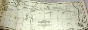
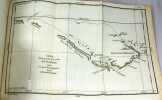
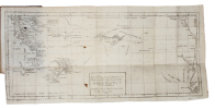
Première édition française, traduite par Anne-François-Joachim de Fréville, illustrée de 3 grandes cartes dépliantes : Partie Méridionale de la mer du sud, Partie de la carte depuis le cap de Bonne Espérance jusqu'à la Nouvelle Bretagne Nouvelle-Zélande, Carte de la Terre des Papous, de la Nouvelle-Guinée et des Iles de Salomon, Nouvelle-Bretagne.C'est une version abrégée de la collection de récits de voyages dans le sud de l'Océan Pacifique publiée en anglais entre 1769 et 1771. Alexender Dalrymple (1737-1808) entra très tôt dans la Compagnie des Indes orientales et réalisa pour celle-ci diverses expéditions dans l'archipel oriental des Indes, notamment en Indonésie. Il devint par la suite hydrographe royal. Ses nombreuses observations permirent le succès du premier voyage de Cook.Brunet II, 474 ; Chadenat, 3184 «Ouvrage important pour l'histoire des découvertes aux terres australes ».
FRÉVILLE, ANNE FRANÇOIS JOACHIM DE (+) [ALEXANDER DALRYMPLE].
Reference : 57765
(1776)
Upsala, Johan Edman, 1776. 8vo. 2 volumes bound in one contemporary half calf binding with five raised bands and gilt lettering to spine. Ex-libris pasted on to pasted down front end-paper. Occassional brownspotting throughout. (28), 308, (2)" (2), 326, (6]) pp. + folded map.
Swedish translation of Fréville's 'Hhistorie des Nouvelles Découvertes...', first published in Paris in 1774, being an abdriged version of Alexander Dalrymple's 'Voyages and Discoveries in the South Pacific Ocean"". Regarding the map Kroepelien notes: ""it was issued sometime after the publication of both volumes and is thus frequently missing.""Kroepelien 471Beddie 721Hill 411Sabin 25913 (1774-edition)