10 books for « cary john »Edit
-
Type
Book (8)
Maps (2)
-
Century
18th (1)
19th (4)
20th (1)
-
Topics
Atlas (1)
Cinema (2)
Colonies (1)
England (1)
Europe (2)
Fishing (1)
Geographical maps (1)
Maps (2)
Photography (1)
Trade (1)
United kingdom (1)
Wales (1)
-
Countries
France (7)
Greece (1)
Switzerland (2)
-
Syndicate
ILAB (7)
NVVA (2)
SLACES (2)
SLAM (4)
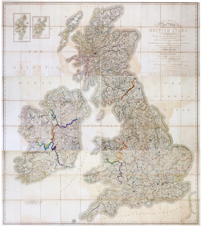
Cary's New Map of the British Isles, exhibiting the whole of the Turnpike roads both direct & cross, particularly distinguishing those on which the mail coaches travel.
London, John Cary, 1819-1833. En trois feuilles coupées en 30 sections chacune, montées sur toile et pliées, pouvant être jointes pour former une carte de 1,91 x 1,71 m ; plats au dos de percaline prune, protégeant les feuilles une fois repliées, avec vignettes portant les titres de North, Center et South ; sous étui de percaline prune avec vignette de titre sur le premier plat.
Rare carte monumentale des Îles Britanniques, dressée et publiée par John Cary en 1819, puis corrigée et publiée à nouveau en 1833. Cette carte très complète et très détaillée présente l'ensemble des routes à péage, tant directes que transversales, en distinguant notamment celles sur lesquelles circulent les diligences postales, les villes où se tiennent les marchés, avec les distances les unes aux autres ainsi qu'avec la métropole, avec les principaux villages, rivières, canaux navigables, parcs, collines, etc. La carte a été dressée d'après les relevés de comtés les plus récents et d'après ceux effectués par l'auteur sur ordre du Post Master General ou chef du système postal. En haut à gauche, en carton, cartes des îles Shetland et Orkney. Contours aquarellés à l'époque. Rousseurs et surimpression de parties imprimées sur des parties voisines, défauts d'usage à l'étui. Fordham, John Cary, Engraver, map, chart and print-seller and globe-maker, 1754 to 1835, 1925, p. 96.


Cary's Reduction of his large map of England and Wales, with part of Scotland; Containing the whole of the Turnpike Roads the principal Rivers & the course of the different Navigable Canals Etc.
1824 London: J. Cary(1830). Folding map. 24 sections laid on linen. Outline hand-colour borders to the county borders. Grubby linen backing with some browning but not generally affecting the map papers.With the original slip-case ,an attractive copy. Originally published in 1796 this reduced issue is pub. by Cary at 86 St James Street and corrected to the year 1830. Scale 15 miles:one inch. Image measures 29.75" x 24.75".. Printed Map.
London : J. Cary, 1830.(). The 1830 revision of the standard map of England and Wales, sanctioned by the Post Master General, which began life in 1796 and continued in use to 1840. Constructed on a scale of fifteen miles to the inch, the turnpike roads, cross roads, navigable rivers, and canals are given particular attention, and differentiations made between cities, market towns, borough towns and smaller towns where yet post-horses and carriages could be supplied. England, Wales and a large portion of Scotland as they stood on the eve of the railway revolution, which was to change the face of the countryside and the concept of transport forever. Copper line engraving on paper, with original outline hand colour. Engraved surface 765 x 620mm (30-1/8" x 24-1/2"). Dissected, mounted on linen, and folding into the publisher's paste-paper slip-case with circular engraved label; the case a little worn; a few slight marks to the map, but overall in very good condition.
A new map of South America
Londres J. Cary 1821 grande carte dépliante de 55 x 93 cm en feuilles, entoilées
Belle carte en long et en couleurs représentant les nouveaux Etats d'Amérique du sud en train d'émerger des guerres de l'indépendance. Elle fut réalisée par John Cary (1754-1835), ou son fils John Cary junior (1791-1852)
Cary's New Map of England and Wales with Part of Scotland... On which are carefully laid down all the direct and principal Cross Roads, the Course of the Rivers and Navigable Canals, Cities, Market and Borough Towns, Parishes and most considerable hamlets, parks, Forests etc...
1794, in-4to, 2 engraved leaves : title and dedication + 14 p. general directions + 77 maps (1-81) incl. general map + 88 p. List of places, In contemporary soft brown leather covers, worn and bumped on corners and edges. (to be rebound).
81 maps including the colored General Map, 85 pages, index followed by a 3 page list of subscribers. 30x24cm folio. A lovely copy, clean tight and untrimmed! (ESTC T149022) The output of Cary’s cartographic firm was prolific and diverse, ranging through maps, plans, atlases, astronomical and educational works, road-books (including works based on surveys by Aaron Arrowsmith the elder, who probably trained him), guides, and globes. See ODNB. 1794. Author GB Image disp.

(SLACES, NVVA)
Phone number : 41 (0)26 3223808
[LONDRES] Cary's new pocket plan of London, Westminster and Southwark; with all the adjacent buildings in St. George's Fields &c &c.
London, J. Cary, 1819. En 16 sections montées sur toile et pliées, formant un plan de 420 x 613 mm.
Beau plan de Londres, Westminster et Southwark, et des villages environnants aujourd'hui intégrés à Londres : Chelsea, Camden, Islington, Brixton, Greenwich, Hackney, Battersea, etc. Il a été finement aquarellé à l'époque, en utilisant un système de couleurs permettant de distinguer les parcs et jardins, les nouveaux docks, les voies principales et quelques monuments importants comme l'Artillery Ground où s'exerçaient les archers. Le plan est accompagné de deux listes des points de relais de la Poste, d'une liste des bâtiments publics, et d'une liste des tarifs des transport en fiacre pour 350 destinations (Hackney coach fares). Très bel exemplaire finement aquarellé à l'époque. Howgego, 192.
![[LONDRES] Cary's new pocket plan of London, Westminster and Southwark; with all the adjacent buildings in St. George's Fields &c &c.. CARY (John).](https://static.livre-rare-book.com/pictures/LBW/lbw-5395_1_thumb.jpg)
A new map of Piedmont, the duchies of Savoy and Milan; and the Republic of Genoa; with their Subdivisions from the latest authorities.
London, printed for J. Cary, Engraver & Map seller, 1799, 45.5x51 cm, belle carte gravée et coloriée, grandes marges, 1 Feuille. 53 x 63.5 cm,
Image disp.

(SLACES, NVVA)
Phone number : 41 (0)26 3223808
Spectacular ! The Story of Epic Films - Publié aux U.S.A. par Castle Books Edition John Kobal 1974
Album à spirales format 315 x 435, couverture illustrée couleurs, 160 pages, bon état, Texte en anglais, ISBN : 0890090017
Essai sur l'état du commerce d'Angleterre. 2 volumes. Tomes I et II
1755 A Londres, et se vend à Paris, Quai des Augustins, chez Guillyn, au Lys d'or - 1755 - Deux volumes in-12 (17 x 10,5 cm) - Plein veau blond de l'époque - Filets et fleurons dorés - Etiquette de titre et de tomaison sur fond brun, toutes tranches rouges - 24 + xlj + 460 + 472 pages - Table des chapitres en fin du tome I. Complet en deux volumes
Intérieur très frais - Reliure bien compacte avec quelques petits accidents - Tome I: Quelques taches foncées dont une importante sur le premier plat , coins légèrement frottés - Petites marques d'érosion sur les coiffes. Manque une des premières pages de garde blanche. Tome II: Quelques galeries de vers à la base du dos, deux accrocs avec manque de matière sur la charnière du premier plat, taches brunes sur les plats, un coin supérieur un peu écrasé, légère érosion sur les coiffes. Quelques noms manuscrits à la plume sur la première page de garde
Spectacular ! The story of epic films
Hamlyn Album à spirale 1974 Grand in-4 à spirales, couverture illustrée couleurs, 160 pp., remarquable étude très richement iconographiée sur les films dits 'à Grand Spectacles', texte en anglais ; quelques incidents à la couverture, assez bel état. Livraison a domicile (La Poste) ou en Mondial Relay sur simple demande.
A New Map of the Russian Empire, Divided into its Governments; from the Latest Authorities
London, 1824 Hand coloured copper engraved map, folding. 100 x 46 printed surface plus margins

Phone number : 00 30 210 3616330
 Write to the booksellers


![[LONDRES] Cary's new pocket plan of London, Westminster and Southwark; with all the adjacent buildings in St. George's Fields &c &c.. CARY (John).](https://static.livre-rare-book.com/pictures/LBW/lbw-5395_1.jpg)


