2 books for « atlas deutschland at... »Edit
-
Topics
Atlas (2)
Germany (2)
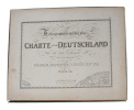
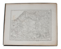
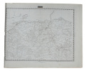
Topographisch-militairischen Charte von Deutschland in 254. Sectionen unternommen von dem Geographischen Institute zu Weimar. (Nur 128 Sectionen).
Weimar, Geographischen Institute, (1807-13). Folio-oblong. Loose sheets in a box. Containg 128 engraved maps, each measuring ca. 30 x 45 cm. Mostly clean and fine, but some with annotations, some with browning and some with traces of use.
Present are the following maps (Sections): 3-12, 17-24, 29-36, 42-48, 53-60, 64-66, 71-74, 80-81, 86-90, 97-98, 103-108, 114-126, 135-142, 151-159, 167-173, 180-186, 193-197, 204-208, 216-219, 227-231, 239-243 and 248-254.
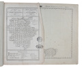
Carte topographique et militaire de L'Allemagne en 204 Feuilles.... (Topographisch-militairischen Charte von Teutschland in 204 Blaettern).
Weimar, Geographischen Instituts, 1807-13. Folio-oblong. (38 x 48 cm.). Contemp hcalf. Spine a little rubbed. A paperlabel pasted on upper part of spine. Corners bumped. Stamp on ""Netz-Karte""/ ""Tableau"". With 3 other ""Netz-Karte"" on verso of Sect. 3,11 a. 14. The engraved title-page (in French) present as Sect. 10. With all 204 engraved plates (203 maps). The maps clean and fine throughout.
 Write to the booksellers


