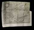
‎Le BAS (Jacques-Philippe).‎
‎Plan de la ville de Syracuse.‎

‎ Dimensions : 294 x 224 mm (dont marges).‎

Reference : 23102


‎ Carte réalisée circa 1800 gravée par Jacques-Philippe Le Bas. Elle est animée de deux embarcations au premier plan. Titre dans un cartouche ornementé. Plissures d'origine. Une marge légèrement effrangée. Du reste, très belle condition. ‎

€50.00 (€50.00 )
Bookseller's contact details

Babel Librairie
M. Mathieu Salzgeber
3, Rue André Saigne
24000 Périgueux
France

babel.librairie@aol.fr

06.84.15.59.05

Contact bookseller

Payment mode
Cheque
Others
Sale conditions

Conformes aux usages de la profession.

Contact bookseller about this book

Enter these characters to validate your form.
*
Send

1 book(s) with the same title

‎[GRAVURE] - ANONYME‎

Reference : A167

(1750)

‎Plan de la ville de Syracuse assiégée par les athéniens. ‎

‎Paris, s.e., s.d. (vers 1750) ; 220/265 mm, 1 pp., une feuille. Plan provenant certainement d'un livre de voyage du XVIIIème siècle. Bon état.‎


Phone number : 03 83 32 77 37

EUR10.00 (€10.00 )
Get it on Google Play Get it on AppStore
The item was added to your cart
You have just added :

-

There are/is 0 item(s) in your cart.
Total : €0.00
(without shipping fees)
What can I do with a user account ?

What can I do with a user account ?

  • All your searches are memorised in your history which allows you to find and redo anterior searches.
  • You may manage a list of your favourite, regular searches.
  • Your preferences (language, search parameters, etc.) are memorised.
  • You may send your search results on your e-mail address without having to fill in each time you need it.
  • Get in touch with booksellers, order books and see previous orders.
  • Publish Events related to books.

And much more that you will discover browsing Livre Rare Book !