BOUGUER (Pierre) & LA CAILLE (Nicolas Louis, abbé de).
Nouveau Traité de Navigation, contenant la Théorie et la Pratique du Pilotage. Par M. Bouguer, de l'Académie Royale des Sciences, de la Société Royale de Londres, & Honoraire de l'Académie de Marine, ci-devant Hydrographe du Roi au Port du Croisic & au Havre-de-Grace. Revu & Abrégé par M. L'Abbé de La Caille de la même Académie Royale des Sciences, &c. Avec Figures en Taille-douce.
A Paris, chez H.L. Guérin & L.F. Delatour, rue S. Jacques, à S. Thomas d'Aquin, 1760. 1760 1 vol. in-8° (206 x 132 mm.) de : XXXII (dont f. bl., faux titre, titre, avertissement, avis au relieur); 352pp; [1] f. (titre); 23 pp. (tables); [1] p. (Remarque); [47] ff. (dont titre, table des Logarithmes); 13 planches dépliantes (dont 6 cartes). (déchirure à une planche). Plein veau de lépoque, dos à nerfs orné. (mors usé, coins frottés).
Reference : 4790
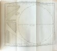
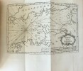
Première édition de cette version abrégée du travail de Pierre Bouguer (1698-1758), mathématicien, physicien, géodésiste et hydrographe français. Cet ouvrage, entreprise considérable qui embrasse l'art du pilote dans toute son étendue, est en effet une version abrégée par Nicolas-Louis de Lacaille dit labbé (1713-1762), astronome français et membre de l'Académie royale des sciences. Publié pour la première fois en 1753, ce traité s'adressait d'abord aux savants, et n'était peut-être pas accessible aux simples pilotes. Dès lors, afin de le rendre accessible à la majorité des jeunes marins qui préparaient leur examen de capitaine au long cours, l'abbé La Caille y apporta quelques modifications. C'est ainsi que louvrage de Bouguer fut réimprimé en 1760, 1769, 1787 et 1792, dans une version revue et augmentée plus accessible. L'illustration se compose de 4 cartes, de la Manche, du Golfe de Gascogne, de l'Atlantique (réduite), et d'une dernière «indiquant avec la direction des vents généraux les Variations qu'avaient la Boussole» (imprimée en rouge et noire) ; des hémisphères austral et boréal représentant les constellations (dessinés et gravé par Dheulland). Bel exemplaire, beau de papier, dans sa reliure d'origine. 1 vol. 8-vo (206 x 132 mm.) of : XXXII (including bl. f., false title, title, warning, notice to the binder) ; 352pp ; [1] f. (title) ; 23 pp. (tables) ; [1] p. (Remark) ; [47] ff. (including title, table of Logarithms) ; 13 folding plates (including 6 maps). (wear to one plate). Contemporary full calf, spine ribbed and decorated. (worn hinge, corners rubbed). First edition of this abridged version of the work of Pierre Bouguer (1698-1758), French mathematician, physicist, geodesist and hydrographer. This work, a considerable undertaking that embraces the art of the pilot in all its extent, is in fact an abridged version by Nicolas-Louis de Lacaille dit l'abbé (1713-1762), French astronomer and member of the Royal Academy of Sciences. Published for the first time in 1753, this treatise was primarily intended for scholars, and was perhaps not accessible to simple pilots. From then on, in order to make it accessible to the majority of young sailors who were preparing their examination for the captain's course, Abbé La Caille made a few modifications. Thus, Bouguer's work was reprinted in 1760, 1769, 1787 and 1792, in a revised and expanded version that was more accessible. The illustration consists of 4 maps, of the English Channel, the Bay of Biscay, the Atlantic (reduced), and a last one "indicating with the direction of the general winds the Variations that the Compass had" (printed in red and black); the southern and northern hemispheres representing the constellations (drawn and engraved by Dheulland). A fine copy in its original binding.
Bookseller's contact details
J-F Letenneur Livres Rares
M. Jean-François Letenneur
11 bd du tertre Gondan
35800 Saint Briac sur Mer
France
librairie@jfletenneurlivresrares.fr
06 81 35 73 35
Payment mode
1 book(s) with the same title
Nouveau Traité de Navigation, contenant la Théorie et la Pratique du Pilotage. Par M. Bouguer, de l'Académie Royale des Sciences, de la Société Royale de Londres, & Honoraire de l'Académie de Marine, ci-devant Hydrographe du Roi au Port du Croisic & au Havre-de-Grace. Revu & Abrégé par M. L'Abbé de La Caille de la même Académie Royale des Sciences, &c. Avec Figures en Taille-douce
A Paris, Chez H.L. Guerin & L.F. Delatour, rue S. Jacques, à S. Thomas d'Aquin. Relié 1760 Un volume in-8° relié (20,4 * 12,8 cm) L'ouvrage s'organise comme suit : la personne qui a fait relié l'ouvrage y a ajouté, les 5 pages d'une plaquette intitulée : examen de la méthode de feu l'abbé de la Caille pour trouver en mer les longitudes, puis le livre commence à proprement dit soit XXXII pages contenant deux feuillets blancs, la page de faux titre, de titre, l'avertissement et l'avis au relieur) puis les 352 pages ; cet exemplaire ne contient pas les (Recueil des tables dressées à l'usage de la navigation), et la table des logarithmes, par contre les 13 planches dépliantes (dont les 6 cartes) ; reliure modeste avec quelques épidermures, mais solide, bon état. Livraison a domicile (La Poste) ou en Mondial Relay sur simple demande.
 Write to the booksellers


