‎ATLAS des PORTS de FRANCE.‎
‎ [BAIE de SEINE] Carte de Fécamp à Luc. - Baie de Seine.‎
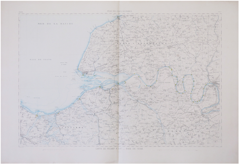
‎ 1878 573 x 827 mm.‎

Reference : LBW-6766


‎Grande carte figurant les environs de la Baie de Seine, avec les départements de la Seine-Inférieure, renommé Seine-Maritime en 1955, du Calvados et de l'Eure, lithographiée en couleurs pour l'Atlas des ports de France, publié sous la direction du Ministère des Travaux Publics. Elle s'étend au nord jusqu'à Fécamp, au sud jusqu'à Lisieux, à l'ouest jusqu'à Caen et à l'est jusqu'à Rouen. Bel exemplaire en coloris de l'époque.‎

€150.00 (€150.00 )
Bookseller's contact details

Librairie Le Bail
Didier Le Bail
13 rue Frédéric Sauton
75005 Paris
France

librairie.lebail@orange.fr

33 01 43 29 72 59

Contact bookseller

Payment mode
Others
Cheque
Others cards

Contact bookseller about this book

Enter these characters to validate your form.
*
Send
Get it on Google Play Get it on AppStore
The item was added to your cart
You have just added :

-

There are/is 0 item(s) in your cart.
Total : €0.00
(without shipping fees)
What can I do with a user account ?

What can I do with a user account ?

  • All your searches are memorised in your history which allows you to find and redo anterior searches.
  • You may manage a list of your favourite, regular searches.
  • Your preferences (language, search parameters, etc.) are memorised.
  • You may send your search results on your e-mail address without having to fill in each time you need it.
  • Get in touch with booksellers, order books and see previous orders.
  • Publish Events related to books.

And much more that you will discover browsing Livre Rare Book !