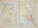
STANFORD (Edward).
South Australia.
London, Edward Stanford, [1896]. 482 x 659 mm.
Reference : LBW-2687
Belle carte figurant la partie est de l'Australie, correspondant aux états du Territoire du Nord, de l'Australie méridionale, du Queensland, de la Nouvelle Galles du Sud et de Victoria. Elle est issue du London Atlas of universal geography de Edward Stanford. Bel exemplaire en coloris de l'époque.
Bookseller's contact details
Librairie Le Bail
Didier Le Bail
13 rue Frédéric Sauton
75005 Paris
France
33 01 43 29 72 59
Payment mode
Sale conditions
Conditions de vente conformes aux usages et aux règlements du Syndicat de la Librairie Ancienne et Moderne (SLAM) et de la Ligue Internationale de la Librairie Ancienne (LILA). Paiements acceptés : cartes bancaires, via un lien de paiement, chèques, virements Conditions of sale in accordance with the practices and regulations of the Syndicat de la Librairie Ancienne et Moderne (SLAM) and the International League of Antiquarian Booksellers (ILAB). Payments accepted: credit cards, via payment link, checks, and bank transfers.
5 book(s) with the same title
The Present State of Australia, including New South Wales, Western Australia, South Australia, Victoria and New Zealand, with practical hints on emigration,. to which are added the land regulations, and description of the aborigines and their habits.
London, G. Willis, 1851, in-8°, frontispiece, xiv + 392 p, map, green publisher's cloth with blind decoration, back with gilt lettering, (cloth discoloured and with some soiling), some pages unopened. About the settlement of Australia and New Zealand, prison discipline in Australia, the penal settlement and the aborigines of Tasmania.
Map of South Australia, New South Wales, Van Diemens Land, and Settled parts of Australia. Respectfully dedicated to Major Sir T.L. Mitchell.
(London), JAs (James) Wyld, (around 1850). (62,5 x 94 cm.). Engraved map, with original outline colourung.. A few small tears in margins, not affecting image.
This large map having insets of Western Australia, plan of Adelaide, plan of Sydney and Van Diemen's Land.
A guide to the genera of Beetles of South Australia - Part 5
Adelaide, South Australian Museum 1987 67pp.with numerous ills., in the "Special educational bulletin series" nr.8
Some new records of fungi for south australia (Part II). Together with a description of a new species of puccinia, pagination 166 à 180.
S. l. (Adelaïde), s.e., s.d. (vers 1920) ; 127 x 200 mm, 16 pp. + 1 pl. hors-texte, couverture et cahier agrafés (3ème-4ème de couverture comportant une déchirure). Tiré à part, en langue anglaise. Transactions of the Royal Society of South Australia (From) Vol. XLVI. 1922. Bon état.
On the habitat and method of occurrence in south Australia of two genera of lycopods hitherto unrecorded for the state.
S. l. (Adelaïde), s.e., s.d. (vers 1920) ; 138 x 214 mm, 12 pp. + 1 pl. hors-texte, couverture et cahier agrafés. Tiré à part, en langue anglaise. Transactions of the Royal Society of South Australia (From) Vol. XLII. 1918. Bon état.
 Write to the booksellers


