 Write to the booksellers
Hassoun Jacques
Les Indes occidentales
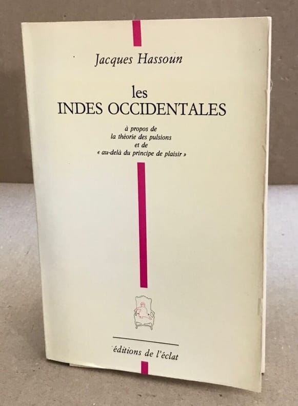
Ed de l'eclat 1987 12x18x0cm. 1987. Broché. 122 pages. Bon Etat intérieur propre
Reference : 100104555
ISBN : 9782905372161
Bookseller's contact details
Livres-sur-sorgue
M. Philippe Arnaiz
04 90 26 49 32
Payment mode

Sale conditions
Conformes aux usages de la librairie ancienne et moderne. Les prix sont nets auxquels il faut ajouter les frais de port. Nous acceptons la carte bancaire. LE PORT EST UNIQUE : 10.00 € PAR COMMANDE ( SUIVI )POUR LA FRANCE 15€ (livres et brochures) POUR L'ETRANGER , L' ENVOI EST RAPIDE , PAIEMENT : CB , CHEQUE , PAYPAL
5 book(s) with the same title
NOUVELLE GEOGRAPHIE UNIVERSELLE - LA TERRE ET LES HOMMES - XVII. INDES OCCIDENTALES - Chapitre premier : Vue d'ensemble - Méditerranée américaine, Découverte et peuplement des Indes occidentales, Répartition politique des Indes occidentales, Caraïbes
LIBRAIRIE HACHETTE & Cie. 1891. In-12. Broché. Bon état, Couv. convenable, Dos satisfaisant, Intérieur frais. Paginé de 1 à 20. Nombreuses gravures en noir et blanc dans et hors texte.. . . . Classification Dewey : 910-Géographie générale. Voyages
Sommaire : Chapitre premier : Vue d'ensemble - Méditerranée américaine, Découverte et peuplement des Indes occidentales, Répartition politique des Indes occidentales, Caraïbes, Nègres, Indiens et Métis, Amérique latine, Isthmes américains Classification Dewey : 910-Géographie générale. Voyages
Histoire de la navigation, son commencement, son progrès et ses découvertes jusqu'à présent. Traduit de l'Anglais. Le commerce des Indes Occidentales. Avec un catalogue des meilleures cartes géographiques et des meilleurs livres de voyages, et le caractère de leurs auteurs.
Paris, Ganeau, 1722. 1 vol. in-12 (sur 2), relié plein , dos à nerfs ornés, pièce de titre et tomaison rouge, 6ff-378pp-3ff (table) , mouillure, charnières fendues , manque au dos ,coiffes usés
Tome 1 seul de l’édition originale de la traduction française de cet ouvrage peu commun. Il est divisé en 2 parties. Dans la première, l'auteur dresse un tableau global de l'histoire de la navigation remontant jusqu'aux premiers bateaux ayant entrepris des traversées périlleuses. Dans la seconde, John Locke aborde majoritairement la découverte des Indes occidentales par Christophe Colomb et les voyages successifs qui l'on suivit. Il y est question des îles de Cuba, de Curaçao, de Martinique, de Guadeloupe, de Grenade ou encore de Saint-Vincent ainsi que des activités des Espagnols, Français, Anglais et Hollandais dans ces îles. Les pages 177 à 316 comportent un Catalogue des meilleures cartes géographiques et des meilleurs livres de voyages, et le caractère de leurs auteurs. (Chadenat 84 )
Atlas des Indes Occidentales, ou Description Géo-Hydrographique des Régions, des Côtes, des Isles, & des Mers, connues sous le nom d'Indes Occidentales, dans laquelle On trouve réunis tous les Détails Géographiques & Nautiques qui appartiennent à c... - [THE WEST-INDIES]
London, Robert Sayer & Jean Bennett, 1777. [Engraved title: London, Sayer & Bennett, 1775]. Folio. Recently bound in a magnificent pastiche-binding of brown half calf with six raised bands and gilt red leather title-label to elaborately gilt spine. Vellum corners and lovely marbled paper over boards. The binding is made over the original one, preserving the original sewn spine underneath as well as the original end-papers. An excellent, beautiful copy. Very clean and fresh. Only minor, light browning to a few maps, and last map with a bit more staining. One map with a small tear to lower margin, far from effecting engraving. Previously in the possession the Danish medieval estate Ravnholt, since the 18th century owned by the noble family of Sehestedt Juul, with discreet stamps from this ownership to title-page: ""Sehestedt Juel"" and ""Rauenholdts Bibliothek"". Title-page (French) + 6 pp. of preface (French) + (2) pp. of index (French) + double-page engraved, illustrated title (English) + 36 double-page and 3 single-page engraved maps, all (but one) dated London, Sayer, 1775 (one map - Antigua - without the year, but London, Sayer).
Scarce first French edition - consisting in all the original 39 maps of the 1775 English edition (all (but Antigua) dated 1775) and the engraved double title-page in English, preceded by a French title, preliminary discourse (also in French), and index - of Jeffery's seminal West-India atlas, one of the most important works on the West Indies and the work that we have to thank for the introduction of ""Carribean"" as the designation that was to become standard on maps. The work played a pivotal rôle in the geo- and cartographical denomination of places and areas in this part of the world. In his preface, Jefferys does away with previous terms applied by geographers: ""La division des Espagnols, & elle se trouve tout-à la fois physique & politique, fut adoptée bientôt par les Anglois, les Hollandois & queslques autres peuples"" la plûpart des navigateurs & des marchands en s'y conformant, ont imposé depuis longtemps à tous les Géographes la nécessité de diviser l'Amerique en trois parties, savoir, ""Amerique du Nord"", ""Indes Occidentales"", ""Amerique du Sud."" Mais les Géographes, surtout les Francois, ont perséveré dans leur ancienne division, probablement parce qu'ils aiment à se répéter, & souvent aussi à se copier l'un l'autre."" (From the preface, p.2). (i.e.: ""The division of the Spanish, and this is found in both physics & polics, was soon adopted by the English, the Dutch & some other populations"" the main part of navigators and merchants have complyed herewith and have long made clear to geographers the necessity to divide America into three parts, namely, ""North America"", ""West Indies"", ""South America."" But geographers, especially the French, have persevered in their old division, probably because they like to repeat, and often also to copy, one another"").But not only does Jefferys extend this denominal division of America to geographers and cartographers, he also (re-)introduces the designation that was to become standard of the Caribbean: ""Les premier Espagnols l'appellèrent Mer du Nord lorsqu'ils eurent découvert une nouvelle mer au delà de l'isthme de Panama. Quelquefois on lui a donné le nom de ""Mer Caribe"" ou ""Caribenne"", qu'il auroit mieux volu adopter que de laisser anonyme un aussi vaste espace."" (From the preface, p. 2, 1).- ""Although the best-known sea of the New World, the Caribbean remained nameless longest. It was the original Mar del Norte, a term promptly extended to all parts of the western atlantic. Velasco tried to find a proper name for it, saying: ""de los Canibales llaman el golfo grande del mar Océano desde de Deseada y Dominica por toda la costa de Tierra Firme, Yucatán, Golfo de Tierra Firme y de las islas del mar del Norte."" This compiler in Spain, regarding the maps before him, made the distinction we do between Caribbean Sea and Gulf of Mexico. (Gulf of Tierra Firme was that of Darién.) Velasco remained in manuscript until the nineteenth century, and I do not know that his Gulf of the Cannibals was ever thus known. In the introduction to his ""West Indian Atlas"", Thomas Jefferys wrote, two centuries later: ""It has been sometimes called the Caribbean-Sea, which name it would be better to adopt, than to leave this space quite anonymous"""" he did so on his map. North European nations at the time were in possession of the Carib islands (the Lesser Antilles) and it is perhaps thus that Jefferys introduced the designation that was to become standard on maps but was not adopted in Spanish lands."" (C.O. Sauer, ""The Early Spanish Main"", p. 2). As one of the earliest documentations of the West Indies, Jefferys' seminal ""West-India Atlas"" was informed by prevailing attitudes about the legitimacy of Britain's colonial enterprises and contemporary debates surrounding the abolition and emancipation movements and played a significant rôle in the spreading of knowledge regarding this part of the world. Jefferys himself, one of the most prominent and prolific map publishers and engravers of his day, was opposed to the slave-trade, which unfortunately hinged upon the sugar trade that the atlas was designed to aid, and also spoke out against it. The English cartographer Thomas Jefferys (c. 1719-1771), ""Royal Geographer to King George III"" was the leading map supplier of his day and as such had access to information that many other cartographers did not. He engraved and printed maps for government and other official bodies and produced a wide range of commercial maps and atlases, most famously of America and the West Indies.Having died in 1771, he did not live to see the publication of his great ""West India Atlas"", which was published by Robert Sayer, who, in partnership with John Bennett, had acquired his maps. Thus, the West India Atlas was published posthumously, under Jefferys' name. Philips III:p. 570.
Histoire de la navigation, son commencement, son progrès et ses découvertes jusquà présent. Le commerce des Indes occidentales.
Paris, Étienne Ganeau, 1722. 1722 2 vol. in-12° (163 x 102 mm) de: I. [6] ff. (titre, préface, approbation, privilège); 378 pp.; [3] ff. (table); II. [4] ff. (titre, table); 316 pp. Plein veau granité dépoque, dos à nerfs orné, titres et tomaisons de maroquin rouge, filet à froid encadrant les plats, roulette dorée sur les coupes, tranches jaspées de rouge. (Rares rousseurs ou tâches).
Première édition en français de cet ouvrage peu commun traduit de langlais sur la base du travail de John Locke (1632-1704). Célèbre philosophe anglais, John Locke est une des figures importantes du rationalisme. Opposé à l'absolutisme en Angleterre et proche du comte de Shaftesbury Anthony Ashley-Cooper (1621-1683), il contribue aux théories naissantes du contrat social, de la loi et du droit naturel, ainsi quà létat de nature. Bien plus tard, à partir du XIXe siècle, on le considérera comme lun des précurseurs du libéralisme. Le premier tome du présent ouvrage traite de : « Histoire de la Navigation, son commencement, ses progrès et ses découvertes jusquà présent ». Dans cette partie, lauteur dresse un tableau global de lhistoire de la navigation remontant jusquaux premiers bateaux ayant entrepris des traversées périlleuses. Le second tome, quant à lui, se concentre sur : « Histoire de la Navigation, le Commerce avec les Indes Occidentales ». Dans cette partie, John Locke aborde majoritairement la découverte des Indes occidentales par Christophe Colomb et les voyages successifs qui lon suivit. Ainsi, il y est question des îles de Cuba, de Curaçao, de Martinique, de Guadeloupe, de Grenade ou encore de Saint-Vincent ainsi que des activités des espagnols, français anglais et hollandais dans ces îles. Enfin, les pp. 177 à 316 comportent : « Un Catalogue des meilleures Cartes Géographiques et des meilleurs Livres de Voyages, et le caractère de leurs auteurs ». Provenance : Jean-Claude Dezauche (1745-1824), ingénieur-géographe, graveur, éditeur et marchand de cartes. (ex-libris gravé au dos des premiers plats). Bel Exemplaire bien conservé. 2 vol. 12mo (163 x 102 mm) of : I. [6] ff. (title, preface, approval, privilege) ; 378 pp. ; [3] ff. (table) ; II. [4] ff. (title, table) ; 316 pp. Full contemporary calf, spine ribbed and decorated, titles and endpapers in red morocco, cold fillet framing the boards, gilt roulette on the edges, edges spotted with red. (Some foxing or stains). First edition in French of this unusual work translated from English and base on the work of John Locke (1632-1704). Famous English philosopher, John Locke is one of the important figures of rationalism. Opposed to absolutism in England and close to the Earl of Shaftesbury, Anthony Ashley-Cooper (1621-1683), he contributed to the emerging theories of social contract, law and natural law, and the state of nature. Much later, from the 19th century on, he was considered one of the precursors of liberalism. The first volume of the present work deals with: "History of Navigation, its beginning, its progress and discoveries until now" (translated from French). In this part, the author talks about the history of navigation as a whole going back to the first ships that undertook perilous crossings. The second volume focuses on: "History of Navigation, Commerce with the West Indies" (translated from French). In this part, John Locke deals mainly with the discovery of the West Indies by Christopher Columbus and the successive voyages that followed. Thus, the islands of Cuba, Curacao, Martinique, Guadeloupe, Grenada and St. Vincent are discussed, as well as the activities of the Spanish, French, English and Dutch in these islands. Finally, pp. 177-316 include: "A Catalogue of the best Geographical Maps and Travel Books, and the character of their authors" (translated from French). Provenance: Jean-Claude Dezauche (1745-1824), engineer-geographer, engraver, publisher and map dealer. (ex-libris engraved on the back of the first plates). Beautiful and well preserved copy.
Phone number : 06 81 35 73 35
HERRERA y TORDESILLAS (Antonio de), COSTE (Nicolas de la ,Trad.)
Reference : PHO-1819
(1671)
Histoire générale des voyages et conquestes des Castillans dans les Isles & Terre-ferme des Indes Occidentales, Traduites de l'espagnol d'Antoine Herrera… par N. de La Coste. Troisième décade seule.
Paris, Veuve Nicolas de la Coste, 1671 ,1 volume in-4° de 14 ff., 9ff-790pp., Troisième décade en plein basane, ex-libris manuscrit au titre, coiffes arasées, coins usés, frottements et griffures, manque l’index.
Rare troisième décade de cette fameuse histoire de l'Amérique par Antonio Herrera y Tordesillas, premier historiographe des Indes Occidentales publiée par la veuve de Nicolas Coste, 11 ans plus tard, en 1671. La première décade comprend les évènements compris en 1492 et 1514, les voyage de Christophe Colomb, les premiers rapports avec les indigènes, les guerres et rivalités politique, etc. Cette seconde décade, composé en 10 chapitres, comprend les événements entre 1515 et 1520, de la conquête du Mexique et d'autres au Mexique, les institutions et coutumes des premières civilisations de la "Nouvelle-Espagne" avant l'arrivée des Européens, les conflits frontaliers avec les Portugais, le passage du détroit par Magellan, etc., la dernière décade se finit en 1526, elle nous conte la mort de Magellan, la continuation de la Conquista par Cortés, Almagro, Pissaro, etc… Antonio Herrera y Tordesillas, surnommé le « Prince des historiens des Indes » est considéré comme le premier historien espagnol de l'Empire d'outre-mer espagnol. First French edition of the third decade of this famous history of America by Antonio Herrera y Tordesillas, first historiographer of the West Indies in three decades, published by the widow of Nicolas Coste, 11 years later, in 1671. This three decade includes the events between 1492 and 1526, from the travels of Colomb, the conquest of Mexico and others in Mexico, the institutions and customs of the first civilizations of "New Spain" before the arrival of Europeans, the border conflicts with the Portuguese, the passage of the strait by Magellan, etc. Réf. : Boucher de la Richarderie : "L'ouvrage d'Herrera est précieux : c'est l'histoire de la découverte et de la conquête de l'Amérique espagnole la plus détaillée que nous ayons.", Brunet III-132, Sabin 31549. P1-Et1