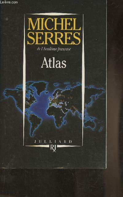
Editions Julliard. 1994. In-8. Broché. Bon état, Coins frottés, Dos satisfaisant, Intérieur acceptable. 279 pages.. . . . Classification Dewey : 910.02-Géographie physique
Reference : RO30354336
ISBN : 2260012078
Classification Dewey : 910.02-Géographie physique
Le-livre.fr / Le Village du Livre
ZI de Laubardemont
33910 Sablons
France
05 57 411 411
Les ouvrages sont expédiés à réception du règlement, les cartes bleues, chèques , virements bancaires et mandats cash sont acceptés. Les frais de port pour la France métropolitaine sont forfaitaire : 6 euros pour le premier livre , 2 euros par livre supplémentaire , à partir de 49.50 euros les frais d'envoi sont de 8€ pour le premier livre et 2€ par livre supplémentaire . Pour le reste du monde, un forfait, selon le nombre d'ouvrages commandés sera appliqué. Tous nos envois sont effectués en courrier ou Colissimo suivi quotidiennement.
Hildburghausen, Joseph Meyer, Bibliographischen Institut, 1848-1853 Folio-oblong (320 x 270 mm). In contemporary half calf. 129 handcoloured maps (Se below for a list of the maps) from ""Meyer’s Groschen-Atlas"", ""Meyer’s Zeitungs-Atlas"", ""Meyer’s Zeitungs und Groschen-Atlas"" and ""Atlas in 64 Karten"". Wear to extremities and hindges weak. All maps brownspottet, primarily affecting margins. A few maps with annotations in pencil and provisional repairs with tape.
LIST OF MAPS CONTAINED IN THE ATLAS: Meyer’s Zeitungs und Groschen-Atlas – Die Oestliche und Westliche Halbkugel der Erde, 1849 Meyer’s Groschen-Atlas – Welt-Charte in Mercators Projektion 1852 Meyer’s Zeitungs-Atlas No. 60 – Erd Karte Meyer’s Zeitungs-Atlas No 82 – Orbis Veteribus Notus Meyer’s Groschen-Atlas – Europa Meyer’s Groschen-Atlas – Asien, 1852 Meyer’s Groschen-Atlas – Africa, 1852 Meyer’s Zeitungs und Groschen-Atlas – America, 1849 Meyer’s Zeitungs und Groschen-Atlas – Asiatischer Archipel und Neu Holland, 1849 Meyer’s Zeitungs-Atlas No. 42 – Der Grosse Ocean und Australien 1849. Meyer’s Zeitungs-Atlas No 115 – Asia-Eüropa Meyer’s Groschen-Atlas – Asia Minor, Syria, Armenia, Mesopotamia, Assyria, Palestina Meyer’s Zeitungs-Atlas, No. 54 – Ostindien, 1853. Meyer’s Zeitungs-Atlas, 65 – Palaestina Meyer’s Groschen-Atlas – Das Asiatische Russland, 1852. Meyer’s Zeitungs-Atlas, No. 127 – Das Osmanische Reich, 1854. Meyer’s Zeitungs-Atlas, No 43 – China-Propria, 1849. Meyer’s Groschen-Atlas – Marocco Algier und Tunis, 1852. Meyer’s Zeitungs und Groschen-Atlas, No. 14 – Agypten, 1849. Meyer’s Zeitungs-Atlas, No. 101 – Senegambien, 1850 Meyer’s Groschen-Atlas – N & S. Carolina, Georgia & Florida, 1853. Meyer’s Groschen-Atlas – Maine New Hampshire, 1853 Meyer’s Groschen-Atlas – New York, Pennsylvania, 185. Meyer’s Groschen-Atlas – Californien, Texas, New Mexico u. Utah, 1852. Meyer’s Groschen-Atlas – Missouri, Illinois, Indiana, Ohio, 1852. Meyer’s Groschen-Atlas – Arkensas, Mississippi, Louisiana & Alabama, 1853. Meyer’s Groschen-Atlas – Nord-America und Mexico, 1852. Meyer’s Groschen-Atlas – Nord-America, 1852. Meyer’s Groschen-Atlas – Süd-America mit Patagonia, 1853. Meyer’s Zeitungs-Atlas, No. 81 – Bolivia, Brasilien, Paraguay, Chile, La Plata, 1850. Meyer’s Groschen-Atlas – Ecuador und Venezuela, 1852. Meyer’s Groschen-Atlas – West Indien und MIttel America. Meyer’s Groschen-Atlas – Brasilien, 1852. Atlas in 64 Karten, No. 10 – Süd-Africa. Meyer’s Groschen-Atlas – Imperium Romanum Meyer’s Groschen-Atlas – Italia Media. Atlas in 64 Karten, No. 35 – Italia Superior Meyer’s Groschen-Atlas – Hispania Meyer’s Zeitungs-Atlas, No. 77 – Græcia Antiqua. Meyer’s Zeitungs-Atlas, No. 87 – Italia Inferior. Meyer’s Zeitungs-Atlas, No. 82 – Peloponnesus. Meyer’s Zeitungs-Atlas, No. 112 – Germanae, Galliae. Meyer’s Zeitungs-Atlas, No. 122 – Das Adriameer, 1852. Meyer’s Zeitungs-Atlas, No. 119 – Italien, 1852. Meyer’s Groschen-Atlas – beider Sicilien, 1853 Meyer’s Groschen-Atlas – Sicilien und Calabrien, 1852. Meyer’s Zeitungs-Atlas, No. 86 – Ober Italien. Meyer’s Zeitungs-Atlas, No. 49 – Frankreich, 1849. Meyer’s Groschen-Atlas – Paris und Gegend. Meyer’s Groschen-Atlas – Sardinien, 1852 Meyer’s Zeitungs-Atlas, No. 24 – Spanien und Portugal. Meyer’s Zeitungs-Atlas, No. 38 – Portugal, 1849. Meyer’s Zeitungs-Atlas, No. 32 – Gross-Britanien und Ireland 1849. Meyer’s Groschen-Atlas – England, 1852. Meyer’s Groschen-Atlas – London, 1853. Meyer’s Groschen-Atlas – Scotland, 1852 Meyer’s Zeitungs-Atlas, No 26 – Ireland, 1849. Meyer’s Zeitungs und Groschen-Atlas – Belgien und Holland, 1849. Meyer’s Zeitungs-Atlas, No. 6 – Holland, 1849 Meyer’s Zeitungs-Atlas, No. 66 – Belgien und Luxemburg, 1849. Meyer’s Zeitungs und Groschen-Atlas, No. 2 – Dänemark und Holstein, 1849. Meyer’s Groschen-Atlas – Schweden Norwegen und Dänemark. Meyer’s Groschen-Atlas – Südliches Schweden, 1852. Meyer’s Groschen-Atlas – Südliche’s Norwegen, 1852. Meyer’s Zeitungs und Groschen-Atlas, No. 7 – Europäische Russland, 1849. Meyer’s Zeitungs-Atlas, No. 50 – Russland. Meyer’s Groschen-Atlas – Grieshenland, 1852. Atlas in 64 Karten, No. 43 – Creta, 1838. Meyer’s Groschen-Atlas – Türkey, 1852. Meyer’s Zeitungs-Atlas, No. 85 – Rumelien, Bulgarien und Walachei, 1850. Meyer’s Groschen-Atlas – Serbien, Bosnien, Montenegriner, 1852. Meyer’s Groschen-Atlas – Schweiz, 1852. Meyer’s Groschen-Atlas – Schwarzen Meeres, 1852. Meyer’s Groschen-Atlas – Polen. Meyer’s Groschen-Atlas, No. 2 – Deutschland. Meyer’s Zeitungs und Groschen-Atlas, No. 7 – Bayern, Würtemberg. Meyer’s Zeitungs-Atlas, No. 125 – Baden, 1854. Meyer’s Groschen-Atlas – Donau Kreis, 1853. Meyer’s Groschen-Atlas – Rhein Bayern, 1853. Meyer’s Zeitungs-Atlas – Grosshz GTH. Hessen, 1853. Meyer’s Zeitungs und Groschen-Atlas, No. 12 – Naassau, 1849. Meyer’s Zeitungs-Atlas, No. 35 – Hessen, 1849. Meyer’s Zeitungs-Atlas, No. 105 – Waldeck, 1850. Meyer’s Groschen-Atlas – Braunschweig, 1853. Meyer’s Groschen-Atlas – Hannover. Meyer’s Zeitungs-Atlas, No. 83 – Anhalt Dessau. Meyer’s Zeitungs-Atlas, No. 20 – Thüringen, 1849. Meyer’s Zeitungs-Atlas, No. 25 – Sachsen-Weimar. Meyer’s Groschen-Atlas – Sachs.Meiningen, 1853. Meyer’s Zeitungs-Atlas, No. 113 – Schwarzburg, 1851. Meyer’s Zeitungs-Atlas, No. 37 – Mecklenburg, 1849. Meyer’s Zeitungs-Atlas, No. 111 – Oldenburg, 1851. Meyer’s Groschen-Atlas – Holstein, 1852. Meyer’s Groschen-Atlas – Schleswig, 1852. Meyer’s Zeitungs-Atlas, No. 21 – Preussen, 1849. Meyer’s Zeitungs-Atlas, No. 59, Niederbrhein, 1849. Meyer’s Zeitungs-Atlas, No. 43 – Iülich-Cleveberg, 1849. Meyer’s Zeitungs-Atlas, No. 53 – Westphalen, 1849. Meyer’s Zeitungs und Groschen-Atlas, No. 34 – Brandenburg, 1849. Meyer’s Zeitungs-Atlas, No. 25 – Sachsen, 1849. Meyer’s Zeitungs und Groschen-Atlas, No. 16 – Schlesien, 1849. Meyer’s Zeitungs und Groschen-Atlas, No. 31 – Pommern, 1849. Meyer’s Zeitungs-Atlas, No. 39 – Ost-Preussen, 1849. Meyer’s Zeitungs-Atlas, No. 27 – West-Preussen, 1849. Meyer’s Zeitungs-Atlas, No. 40 – Posen, 1849. Meyer’s Zeitungs und Groschen-Atlas, No. 3 – Oesterreich, 1849. Meyer’s Zeitungs-Atlas, No. 47 – Oesterreich: Ob der Enns, 1849. Meyer’s Groschen-Atlas – Oesterreich Unter der Enns, 1853. Meyer’s Zeitungs-Atlas, No. 117 – Kærnthen, 1852. Meyer’s Groschen-Atlas – Tyrol, 1852. Meyer’s Zeitungs-Atlas, No. 51 – Böhmen, 1849. Meyer’s Zeitungs und Groschen-Atlas, No. 13 – Ungarn, Siebenbürgen, 1849. Meyer’s Groschen-Atlas – Lombardisch-Venetianisches, 1853 Meyer’s Zeitungs-Atlas, No. 96 – Umrisse der Pflanzengeographie. Meyer’s Groschen-Atlas – Übersicht der Kulturpflanzen. Meyer’s Zeitungs-Atlas, No. 110 – Karte von Europa. Meyer’s Zeitungs-Atlas, No. 94 – Europa Meyer’s Groschen-Atlas – Höhen und Orte Erde. Meyer’s Zeitungs-Atlas, No. 104 – Stromlängen. Meyer’s Groschen-Atlas – Hyetographische Karte der Erde. Meyer’s Groschen-Atlas – Windkarte der Erde. Meyer’s Groschen-Atlas – Magnetischen Meridiane. Meyer’s Groschen-Atlas – Magnet-Karte Meyer’s Zeitungs-Atlas, No. 93 – Die Isothermkurven Meyer’s Groschen-Atlas – Mittelamerica. Meyer’s Groschen-Atlas – Die Vulkan Gürtel des Atlantischen Oceans. Meyer’s Zeitungs-Atlas, No. 98 – Karte der Grossen Ocean. Meyer’s Groschen-Atlas – Indischen Meere Meyer’s Zeitungs-Atlas, No. 97 – Deutschen Meere
Amsterdam, Labore & Sumptibus - Johannis Blaeu, 1662. Large folio (350 x 545 mm). In publisher’s full vellum binding with central gilt arabesque and armillary sphere. All edges gilt. Boards with stains and marks. Outer margin on back board with waterstain. Small stamp on front free end-paper, lower part of title-page and lower part of frontiespiece (The Royal Danish Geographical Society). Occassional light brownpostting throughout. Approximately 50 leaves with waterstain in outer margin, primarily affecting last part. (4), 256, (2), 78, (2) + 70 engraved maps. Complete, corresponds to Koemann Bl 56, 220.
First edition of volume seven, containing France and Switzerland, of Blaeu’s monumental Atlas Major, one of the most significant works of the 17th century widely considered to be one of the greatest atlases ever produced. It was the most expensive book that could be acquired in the mid-17th century. The Atlas Major was a significant achievement in the history of cartography and it represented a major step forward in the development of the modern atlas. Most of the present maps were issued in previous editions of Blaeu’s atlases from the 1630s onwards, and derive variously from Maurice Bouguereau’s Le Théatre Francoys (1594), Jean le Clerc’s Le Théatre géographique du Royaume de France (1619), as well as from other maps by Hondius and Janssonius. ""There are a small number of newer maps of France, some of which derived from the Geographer to the King of France, Pierre Du Val. The six maps of Switzerland in the atlas had been in print for several decades: four of them were copied from Mercator’s 1585 Galliae Tabulae geographicae."" (National Library of Scotland). The Atlas Major was notable for its high level of accuracy and detail. The maps were based on the latest geographical knowledge and featured state-of-the-art cartographic techniques, such as the use of latitudinal and longitudinal coordinates, and a sophisticated system of map projection. The maps were also notable for their beautiful engravings and illustrations, which were produced by some of the most talented artists of the time. The Atlas Maior was a major commercial success and it was widely used by scholars, navigators, and government officials. It was translated into several languages, and it became the standard reference work for cartography and geography during the 17th century. Atlas Major was subsequently published with French, Dutch, German, and Spanish texts. Koemann Bl 56, 220.
Maradan A Paris, chez Maradan An II. 1794. Atlas in-Folio relié sous couverture d'attente cartonnée de l'époque. Le papier est manquant en dos de la reliure. Traduit de l'Allemand par le Cit. Gauthier de la Peyronie. Nouvelle édition revue et enrichie de notes par les C C. Lamarck, Professeur de géologie au Muséum National d'Histoire Naturelle ; Langlès, Sous-Garde des manuscrits de la Bibliothèque Nationale, pour les langues Arabe, Persane, Tatane-Mantchoue, & Billecocq, Homme de lettres. Contenant la Carte générale de l'Empire de Russie, d'après la nouvelle division de cet Empire en quarante-deux gouvernemens ; dix Cartes Géographiques ; soixante-dix-sept planches de botanique ; douze autres représentant des fourneaux, moulins, monumens & ; onze d'idoles et costumes ; et onze d'animaux, d'Histoire naturelle, d'Hiéroglyphes, &. Atlas bien complet des 108 planches dont douze dépliantes. Celles-ci sont toutes montées sur onglets et classées selon la disposition de l'édition in-8. Déchirure sans manque au bas de la planche 33 - 33 bis, sans manque. Monument cartographique et iconographique de l'exploration des Lumières, cet atlas fut dressé pour consigner les découvertes de la « Grande Expédition académique » (1768-1774) financée par l'impératrice Catherine II. Sous la direction du médecin, géologue et naturaliste prussien Peter Simon Pallas, la mission parcourut plus de 20 000 kilomètres à travers les territoires les plus reculés de l'Empire russe, de la Volga aux frontières de la Chine impériale (Kyakhta), en traversant le Caucase, l'Oural, le bassin de l'Irtysh et le lac Baïkal. Traduit par Gauthier de La Peyronie et publié sous la Révolution par le libraire Marandan, cet atlas constitue la documentation visuelle de référence sur le Nord de l'Asie au XVIII siècle. Atlas seul de cette importante relation scientifique commandée par Catherine II. Il rassemble l'iconographie et la cartographie de l'expédition menée par le naturaliste Pallas à travers l'Oural, la Sibérie, les bords de la mer Caspienne et les confins de la Chine. Bon exemplaire
Toutes les expéditions sont faites en suivi au-dessus de 25 euros. Expédition quotidienne pour les envois simples, suivis, recommandés ou Colissimo.
Nürnberg, Homannischen Officin, n.date (maps ca 1720-39). Large folio. 54,5x32 cm. Contemporary, probably original, limp full calf with flap (""portmanteau""). (Only 4 maps with dating: 2 with 1732, 1728 and 1739).Cover with blind-tooled frames inside which a crowned monogram and the number 50 (= number of plates). Binding worn at edges, covers and back somewhat rubbed. Flap torn and partly with an old repair. Fine allegorical engraved hand-coloured title, printed title with Index (these 2 leaves strengthened in lower margin, no loss of image), and all 49 engraved maps, all in fine original hand-colouring and in double-folio. In excellent condition, with large cartouches (cartouches uncoloured). A few maps with insignificant small tears in folding. The title-page engraved by Michael Rössler, pointing to an early issue of the atlas, and before the publishing house had its name changed to Homann Erben (from 1730).
A fine, complete and early atlas from the famous Nürnberger map-maker and publisher, J.B. Homann, geographer to the Kaiser (Emperor). The atlas comprises: Engraved Title. The hemispheres. Europe. Asia. Africa. America. Spain & Portugal. France (Galliæ). England. Holland & Belgium. Belgia etc.. Holland. Schweitz. Italy. Savoye. Milano etc.. Florenz. Naples. Sicily. Germany. Austria. German Provinces 18 maps. Slesvig. Holstein. Scandinavia. Denmark. Sweden & Finland. Poland. Preussen. Russia. Hungary & Greece. Palestine.
London, Robert Sayer & Jean Bennett, 1777. [Engraved title: London, Sayer & Bennett, 1775]. Folio. Recently bound in a magnificent pastiche-binding of brown half calf with six raised bands and gilt red leather title-label to elaborately gilt spine. Vellum corners and lovely marbled paper over boards. The binding is made over the original one, preserving the original sewn spine underneath as well as the original end-papers. An excellent, beautiful copy. Very clean and fresh. Only minor, light browning to a few maps, and last map with a bit more staining. One map with a small tear to lower margin, far from effecting engraving. Previously in the possession the Danish medieval estate Ravnholt, since the 18th century owned by the noble family of Sehestedt Juul, with discreet stamps from this ownership to title-page: ""Sehestedt Juel"" and ""Rauenholdts Bibliothek"". Title-page (French) + 6 pp. of preface (French) + (2) pp. of index (French) + double-page engraved, illustrated title (English) + 36 double-page and 3 single-page engraved maps, all (but one) dated London, Sayer, 1775 (one map - Antigua - without the year, but London, Sayer).
Scarce first French edition - consisting in all the original 39 maps of the 1775 English edition (all (but Antigua) dated 1775) and the engraved double title-page in English, preceded by a French title, preliminary discourse (also in French), and index - of Jeffery's seminal West-India atlas, one of the most important works on the West Indies and the work that we have to thank for the introduction of ""Carribean"" as the designation that was to become standard on maps. The work played a pivotal rôle in the geo- and cartographical denomination of places and areas in this part of the world. In his preface, Jefferys does away with previous terms applied by geographers: ""La division des Espagnols, & elle se trouve tout-à la fois physique & politique, fut adoptée bientôt par les Anglois, les Hollandois & queslques autres peuples"" la plûpart des navigateurs & des marchands en s'y conformant, ont imposé depuis longtemps à tous les Géographes la nécessité de diviser l'Amerique en trois parties, savoir, ""Amerique du Nord"", ""Indes Occidentales"", ""Amerique du Sud."" Mais les Géographes, surtout les Francois, ont perséveré dans leur ancienne division, probablement parce qu'ils aiment à se répéter, & souvent aussi à se copier l'un l'autre."" (From the preface, p.2). (i.e.: ""The division of the Spanish, and this is found in both physics & polics, was soon adopted by the English, the Dutch & some other populations"" the main part of navigators and merchants have complyed herewith and have long made clear to geographers the necessity to divide America into three parts, namely, ""North America"", ""West Indies"", ""South America."" But geographers, especially the French, have persevered in their old division, probably because they like to repeat, and often also to copy, one another"").But not only does Jefferys extend this denominal division of America to geographers and cartographers, he also (re-)introduces the designation that was to become standard of the Caribbean: ""Les premier Espagnols l'appellèrent Mer du Nord lorsqu'ils eurent découvert une nouvelle mer au delà de l'isthme de Panama. Quelquefois on lui a donné le nom de ""Mer Caribe"" ou ""Caribenne"", qu'il auroit mieux volu adopter que de laisser anonyme un aussi vaste espace."" (From the preface, p. 2, 1).- ""Although the best-known sea of the New World, the Caribbean remained nameless longest. It was the original Mar del Norte, a term promptly extended to all parts of the western atlantic. Velasco tried to find a proper name for it, saying: ""de los Canibales llaman el golfo grande del mar Océano desde de Deseada y Dominica por toda la costa de Tierra Firme, Yucatán, Golfo de Tierra Firme y de las islas del mar del Norte."" This compiler in Spain, regarding the maps before him, made the distinction we do between Caribbean Sea and Gulf of Mexico. (Gulf of Tierra Firme was that of Darién.) Velasco remained in manuscript until the nineteenth century, and I do not know that his Gulf of the Cannibals was ever thus known. In the introduction to his ""West Indian Atlas"", Thomas Jefferys wrote, two centuries later: ""It has been sometimes called the Caribbean-Sea, which name it would be better to adopt, than to leave this space quite anonymous"""" he did so on his map. North European nations at the time were in possession of the Carib islands (the Lesser Antilles) and it is perhaps thus that Jefferys introduced the designation that was to become standard on maps but was not adopted in Spanish lands."" (C.O. Sauer, ""The Early Spanish Main"", p. 2). As one of the earliest documentations of the West Indies, Jefferys' seminal ""West-India Atlas"" was informed by prevailing attitudes about the legitimacy of Britain's colonial enterprises and contemporary debates surrounding the abolition and emancipation movements and played a significant rôle in the spreading of knowledge regarding this part of the world. Jefferys himself, one of the most prominent and prolific map publishers and engravers of his day, was opposed to the slave-trade, which unfortunately hinged upon the sugar trade that the atlas was designed to aid, and also spoke out against it. The English cartographer Thomas Jefferys (c. 1719-1771), ""Royal Geographer to King George III"" was the leading map supplier of his day and as such had access to information that many other cartographers did not. He engraved and printed maps for government and other official bodies and produced a wide range of commercial maps and atlases, most famously of America and the West Indies.Having died in 1771, he did not live to see the publication of his great ""West India Atlas"", which was published by Robert Sayer, who, in partnership with John Bennett, had acquired his maps. Thus, the West India Atlas was published posthumously, under Jefferys' name. Philips III:p. 570.