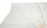
"FORTIFICATION OF VARNA (ODESSA) BULGARIA - OROGRAPHIC MANUSCRIPT MAP WITH 19 FORTIFICATIONS.
Proekt ukrepleniya g. Varna (i.e.: ""A project of the fortification of town of Varna""). Dopol. Otd. Sht. Kapitan (Stabskapitän, staff captain) Sedel'nikov.
Varna 1888-89. 131 x 126 cm. joined by 4 sheets. Large manuscript surveying map of the fortress of Varna and its vicinity of with contour lines and defensive fortresses, including the fortified lines along the Black Sea coast. Depicting in all 19 defensive installations in all directions from Varna. Surveyed by the Russian captain, Kapitan Scrodel'uikov. Pen and ink with watercolour. With scale. On good thick paper. With 4 small punched holes (stars).
Reference : 59218
€1,341.22
(€1,341.22
)
Bookseller's contact details
Herman H. J. Lynge & Son
William Schneider
Silkegade 11
1113 Copenhagen
Denmark
+45 33 155 335
Payment mode
Cheque
Transfer
Others
Sale conditions
All items may be returned for a full refund for any reason within 14 days of receipt.
 Write to the booksellers


