NIEBUHR, CARSTEN.
Reize naar Arabië en andere omliggende landen. Uit het Hoogduitsch vertaald. 2 parts. - [NIEBUHR'S GREAT TRAVEL ACCOUNT OF THE MIDDLE EAST]
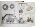
Amsterdam, 1776-1780. 4to. Bound in two contemporary uniform brown half calf bindings with gilt lines and gilt title-labels to spines. Spines with some wear and tear and vol. 2 with a couple of glue-repairs to upper capital. A small marginal damp stain to first quire of vol. 2 and (mostly very faint) marginal damp stain later on as well, otherwise internally very nice and clean. Tt2 with a tear to top margin, no loss. Beautiful allegorical vignettes to title-pages. VIII, (6), 484, (1, -errata) + 71 engraved plates (out of 72) + engraved folded map" (16), 455, (1) pp. + 52 engraved plates. In all with 123 splendid engraved plates, many of them folded, out of 124 - missing plate 29 in vol. 1. + the famous map of Yemen.
Reference : 54723
First Dutch edition of Nieburh's great travel account of Arabia, originally published in Copenhagen, 1774-78, in German under the title ""Reisebeschreibung von Arabien"". This splendid and extremely important work on the Middle East, Egypt, Persia and India ""provided a mass of new geographical, regional, and historical information... Among is many exact maps and plans, the map of the Red Sea and of Yemen served as the most reliable information for more than 50 years.""""Despite its tragic course, the expedition was a complete success with regard to its scientific and scholarly results. It was especially due to Niebuhr's efforts to preserve and continue his and his collegues' , that the Royal Danish Library was eventually equipped with a host of oriental manuscripts, maps, and drawings, as well as many botanical and zoological specimens... It was Niebuhr who edited and published Forskåll's Flora Aegyptiaco-Arabica (1775) and Descriptiones Animalium (1775), together with the drawings of bauerfeind. In 1772 he had alredy published his systematic and geographically organized beschreibung von Arabien, which was followed between 1774 and 1778 by the first two volume of his three-volume chronologically arranged Reisebeschreibung nach Arabien. (the item offered, the third volume was published many years later, 1837). Both works, written in a clear and sober language and illustrated with numerous precise drawings, maps, and plans, provided a mass of new geographical, regional, and historical information... Among is many exact maps and plans, the map of the Red Sea and of yemen served as the most reliable information for more than 50 years."" (Josef Wiesehöfer).
Bookseller's contact details
Herman H. J. Lynge & Son
William Schneider
Silkegade 11
1113 Copenhagen
Denmark
+45 33 155 335
Payment mode
Sale conditions
All items may be returned for a full refund for any reason within 14 days of receipt.
 Write to the booksellers


