 Write to the booksellers
BLAEU Joan
Atlas Major
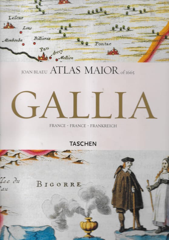
Cartonnage d'éditeur sous jaquette illustrée. Taschen 2006 1 volume in-folio.
Reference : 7687
Bookseller's contact details
Librairie Seigneur
Martine Seigneur
Payment mode

Sale conditions
Conforme aux usages de la profession.
5 book(s) with the same title
Geographiae Blauianae volumen septimum, quo liber XIV,XV, Europae continentur. (France and Switzerland). - [BLAEU'S ATLAS MAJOR ON FRANCE AND SWITZERLAND]
Amsterdam, Labore & Sumptibus - Johannis Blaeu, 1662. Large folio (350 x 545 mm). In publisher’s full vellum binding with central gilt arabesque and armillary sphere. All edges gilt. Boards with stains and marks. Outer margin on back board with waterstain. Small stamp on front free end-paper, lower part of title-page and lower part of frontiespiece (The Royal Danish Geographical Society). Occassional light brownpostting throughout. Approximately 50 leaves with waterstain in outer margin, primarily affecting last part. (4), 256, (2), 78, (2) + 70 engraved maps. Complete, corresponds to Koemann Bl 56, 220.
First edition of volume seven, containing France and Switzerland, of Blaeu’s monumental Atlas Major, one of the most significant works of the 17th century widely considered to be one of the greatest atlases ever produced. It was the most expensive book that could be acquired in the mid-17th century. The Atlas Major was a significant achievement in the history of cartography and it represented a major step forward in the development of the modern atlas. Most of the present maps were issued in previous editions of Blaeu’s atlases from the 1630s onwards, and derive variously from Maurice Bouguereau’s Le Théatre Francoys (1594), Jean le Clerc’s Le Théatre géographique du Royaume de France (1619), as well as from other maps by Hondius and Janssonius. ""There are a small number of newer maps of France, some of which derived from the Geographer to the King of France, Pierre Du Val. The six maps of Switzerland in the atlas had been in print for several decades: four of them were copied from Mercator’s 1585 Galliae Tabulae geographicae."" (National Library of Scotland). The Atlas Major was notable for its high level of accuracy and detail. The maps were based on the latest geographical knowledge and featured state-of-the-art cartographic techniques, such as the use of latitudinal and longitudinal coordinates, and a sophisticated system of map projection. The maps were also notable for their beautiful engravings and illustrations, which were produced by some of the most talented artists of the time. The Atlas Maior was a major commercial success and it was widely used by scholars, navigators, and government officials. It was translated into several languages, and it became the standard reference work for cartography and geography during the 17th century. Atlas Major was subsequently published with French, Dutch, German, and Spanish texts. Koemann Bl 56, 220.
AVIATION MAGAZINE INTERNATIONAL N° 533 - Les chaines de l'Atlas, les conséquences du choix de la formule tri réacteur par le groupe Atlas, les raisons qui ont conduit a l'ajournement de la décision, Une interview exclusive du chef d'Etat Major de l'armée
UNION DE PRESSE EUROPEENNE. 1-14 MARS 1970. In-12. Broché. Bon état, Couv. convenable, Dos satisfaisant, Intérieur frais. 93 pages. Nombreuses illustrations en couleurs et noir et blanc dans et hors texte.. . . . Classification Dewey : 629.1-Aviation
Sommaire : Les chaines de l'Atlas, les conséquences du choix de la formule tri réacteur par le groupe Atlas, les raisons qui ont conduit a l'ajournement de la décision, Une interview exclusive du chef d'Etat Major de l'armée de l'air, le général G. Gauthier, Le budget spatial US pour 1971 Classification Dewey : 629.1-Aviation
Reference : albddedde5f0e103a9a
Atlas: Morphodynamics of the estuaries of major rivers of the Arctic coast of
Atlas: Morphodynamics of the estuaries of major rivers of the Arctic coast of Russia. In Russian /Atlas: morfodinamika ustevykh sistem krupnykh rek Arkticheskogo poberezhya Rossii. Rev. Ed. V. N. Korotaev et al. M. APR 2017. 148 p. We have thousands of titles and often several copies of each title may be available. Please feel free to contact us for a detailed description of the copies available. SKUalbddedde5f0e103a9a.
Reference : alb39ac6c02149ae140
Dr. E. Jacobi: Atlas of Skin Diseases Including Major Venereal Diseases. In Rus
Dr. E. Jacobi: Atlas of Skin Diseases Including Major Venereal Diseases. In Russian (ask us if in doubt)/Yakobi E.(Dr. E. Jacobi). Atlas bolezney kozhi s vklyucheniem vazhneyshikh venericheskikh zabolevaniy.Second Russian Edition. St. Petersburg. Oettinger. 1910. 150 p. We have thousands of titles and often several copies of each title may be available. Please feel free to contact us for a detailed description of the copies available. SKUalb39ac6c02149ae140
Reference : alb1692a5f4df602999
Jacobi E. Atlas of Skin Diseases Including Major Venereal Diseases. In Russian
Jacobi E. Atlas of Skin Diseases Including Major Venereal Diseases. In Russian (ask us if in doubt)/Yakobi E. Atlas bolezney kozhi s vklyucheniem vazhneyshikh venericheskikh zabolevaniy.St. Petersburg. Practical Medicine 1913. 189 p. We have thousands of titles and often several copies of each title may be available. Please feel free to contact us for a detailed description of the copies available. SKUalb1692a5f4df602999